Montgomery County, Alabama
Montgomery County is a county located in the southeast-central part of the State of Alabama. As of the 2010 census, its population was 229,363, making it the fourth-most populous county in Alabama.[2] Its county seat is Montgomery, the state capital.[3]
Montgomery County | |
|---|---|
| Montgomery County | |
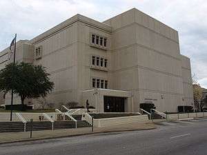 The Montgomery County Courthouse | |
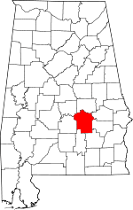 Location within the U.S. state of Alabama | |
 Alabama's location within the U.S. | |
| Coordinates: 32°13′09″N 86°12′34″W | |
| Country | |
| State | |
| Founded | December 6, 1816[1] |
| Named for | Lemuel P. Montgomery |
| Seat | Montgomery |
| Largest city | Montgomery |
| Area | |
| • Total | 800 sq mi (2,000 km2) |
| • Land | 784 sq mi (2,030 km2) |
| • Water | 16 sq mi (40 km2) 2.0%% |
| Population (2010) | |
| • Total | 229,363 |
| • Estimate (2019) | 226,486 |
| • Density | 290/sq mi (110/km2) |
| Time zone | UTC−6 (Central) |
| • Summer (DST) | UTC−5 (CDT) |
| Congressional districts | 2nd, 3rd, 7th |
| Website | www |
| |
Montgomery County is included in the Montgomery, AL Metropolitan Statistical Area.
History
Montgomery County was established by dividing Monroe County on December 6, 1816, by the Mississippi Territorial Legislature.[1] It is named for Lemuel P. Montgomery, a young U.S. Army officer killed at the Battle of Horseshoe Bend, the final battle of the Creek Indian war, which was waged concurrently with the War of 1812.[4]
The city of Montgomery, which is the county seat, is named for Richard Montgomery, an American Revolutionary War general killed in 1775 while attempting to capture Quebec City, Canada.[4]
Over much of the 19th century great wealth was derived from the cotton crop, with the Civil War producing a temporary setback. More lasting trouble came in 1914 with the arrival of the boll weevil, which became very destructive to the cotton harvest from 1915 on.[5] By the 1940s county farms earned more from cattle than cotton.[6]
Geography
According to the U.S. Census Bureau, the county has a total area of 800 square miles (2,100 km2), of which 784 square miles (2,030 km2) is land and 16 square miles (41 km2) (2.0%) is water.[7]
Major highways
.svg.png)
.svg.png)
.svg.png)


Adjacent counties
- Elmore County (north)
- Macon County (northeast)
- Bullock County (east)
- Pike County (southeast)
- Crenshaw County (southwest)
- Lowndes County (west)
- Autauga County (northwest)
National protected area
Demographics
| Historical population | |||
|---|---|---|---|
| Census | Pop. | %± | |
| 1820 | 6,604 | — | |
| 1830 | 12,695 | 92.2% | |
| 1840 | 24,574 | 93.6% | |
| 1850 | 29,711 | 20.9% | |
| 1860 | 35,904 | 20.8% | |
| 1870 | 43,704 | 21.7% | |
| 1880 | 52,356 | 19.8% | |
| 1890 | 56,172 | 7.3% | |
| 1900 | 72,047 | 28.3% | |
| 1910 | 82,178 | 14.1% | |
| 1920 | 80,853 | −1.6% | |
| 1930 | 98,671 | 22.0% | |
| 1940 | 114,420 | 16.0% | |
| 1950 | 138,965 | 21.5% | |
| 1960 | 169,210 | 21.8% | |
| 1970 | 167,790 | −0.8% | |
| 1980 | 197,038 | 17.4% | |
| 1990 | 209,085 | 6.1% | |
| 2000 | 223,510 | 6.9% | |
| 2010 | 229,363 | 2.6% | |
| Est. 2019 | 226,486 | [8] | −1.3% |
| U.S. Decennial Census[9] 1790–1960[10] 1900–1990[11] 1990–2000[12] 2010–2018[2] | |||
2010
The 2010 United States Census reported the following county population:
- 39.5% White
- 54.7% Black
- 0.3% Native American
- 1.2% Asian
- 0.0% Native Hawaiian or Pacific Islander
- 1.3% Two or more races
- 3.6% Hispanic or Latino (of any race)
2000
As of the census of 2000, there were 223,510 persons, 86,068 households, and 56,804 families in the county. The population density was 283 persons per square mile (109/km2). There were 95,437 housing units, at an average density of 121 per square mile (47/km2). The racial makeup of the county was 48.85% White, 48.58% Black or African American, 0.99% Asian, 0.25% Native American, 0.03% Pacific Islander, 0.35% from other races, and 0.94% from two or more races. Hispanics and Latinos, of any race, made up 1.19% of the population.
By 2005, 52.5% of the population was black, 44.0% was non-Hispanic white, 1.4% was Hispanic, 1.2% was Asian, 0.2% was Native American, and 0.9% of the population reported two or more races. This excludes those who reported "some other race" and "white," because the Census Bureau reclassified all who reported "some other race" as white.
There were 86,068 households, 32.20% of which included children under the age of 18, 43.80% were married couples living together, 18.60% had a female householder with no husband present, and 34.00% were non-families. Single-persons households were 29.50% of the total; 9.40% had someone living alone who was 65 years of age or older. The average household size was 2.46. The average family size was 3.06.
Persons younger than 18 were 25.80% of the population; those 18–24, 11.70%; 25–44, 29.80%; 45–64, 20.90%; and 65 and older, 11.80%. The median age was 34 years. For every 100 females, there were 90.80 males. For every 100 females aged 18 and over, there were 86.70 males.
The median income for a household in the county was $35,962, and the median income for a family was $44,669. Males had a median income of $32,018; females, $24,921. The per capita income for the county was $19,358. About 13.50% of families and 17.30% of the population were below the poverty line, including 25.10% of those under age 18 and 13.70% of those 65 and older.
Government, politics and infrastructure
Montgomery County is governed by a five-member County Commission who are elected to four-year terms. The County Probate Judge regulates business such as drivers, marriage licences, and voting. The Probate Judge operates four offices: downtown Montgomery, Mobile HWY (Montgomery), Woodley Road (Montgomery), and Atlanta HWY (Montgomery).
The City of Montgomery, located inside Montgomery County, serves as the capital for the State of Alabama and is home to most state government agencies.
In the 2008 presidential election, Barack Obama won 62,166 votes, or 59 percent, while 42,031 votes (40 percent of those cast) were for John McCain[13]
| Year | GOP | DEM | Others |
|---|---|---|---|
| 2016 | 35.5% 34,003 | 61.5% 58,916 | 3.1% 2,959 |
| 2012 | 37.6% 38,332 | 61.8% 63,085 | 0.6% 650 |
| 2008 | 40.1% 42,031 | 59.4% 62,166 | 0.5% 546 |
| 2004 | 49.2% 44,097 | 50.4% 45,160 | 0.4% 393 |
| 2000 | 48.3% 38,827 | 50.3% 40,371 | 1.4% 1,130 |
| 1996 | 48.0% 37,784 | 48.7% 38,382 | 3.3% 2,578 |
| 1992 | 47.3% 40,742 | 43.3% 37,342 | 9.4% 8,068 |
| 1988 | 58.4% 41,131 | 40.8% 28,709 | 0.8% 551 |
| 1984 | 57.8% 43,328 | 41.6% 31,206 | 0.6% 471 |
| 1980 | 53.8% 35,745 | 42.1% 28,018 | 4.1% 2,741 |
| 1976 | 53.6% 29,360 | 45.0% 24,641 | 1.3% 732 |
| 1972 | 71.9% 35,353 | 25.9% 12,723 | 2.3% 1,121 |
| 1968 | 14.5% 6,746 | 26.0% 12,088 | 59.5% 27,691 |
| 1964 | 75.5% 23,015 | 24.5% 7,482 | |
| 1960 | 54.9% 11,778 | 43.9% 9,421 | 1.2% 249 |
| 1956 | 46.3% 8,727 | 36.6% 6,890 | 17.1% 3,224 |
| 1952 | 46.2% 8,102 | 52.7% 9,234 | 1.1% 193 |
| 1948 | 11.1% 802 | 88.9% 6,402 | |
| 1944 | 4.0% 381 | 95.6% 9,143 | 0.4% 38 |
| 1940 | 2.0% 230 | 97.7% 11,311 | 0.3% 32 |
| 1936 | 1.8% 223 | 97.8% 12,061 | 0.4% 48 |
| 1932 | 4.2% 441 | 95.6% 10,066 | 0.3% 26 |
| 1928 | 32.9% 3,114 | 67.1% 6,347 | 0.0% 3 |
| 1924 | 4.6% 233 | 87.7% 4,422 | 7.7% 387 |
| 1920 | 4.6% 314 | 94.6% 6,411 | 0.7% 50 |
| 1916 | 3.1% 106 | 96.1% 3,316 | 0.9% 30 |
| 1912 | 1.3% 43 | 94.1% 3,047 | 4.6% 148 |
| 1908 | 2.9% 79 | 96.5% 2,621 | 0.6% 15 |
| 1904 | 2.0% 50 | 97.5% 2,492 | 0.5% 13 |
Infrastructure inside Montgomery County includes both Interstate 85 and 65 along with shipping hubs on the Alabama River and rail hubs located in the City of Montgomery. The Montgomery Regional Airport also serves as a major airport for the State of Alabama and the Southeastern US for passenger service, military aviation, and commercial aviation.
Education

Montgomery Public Schools operates public schools.
The Montgomery City-County Public Library operates public libraries.
Universities/Colleges include:
- Alabama Agricultural and Mechanical University
- Huntingdon College
- Faulkner University
- Alabama State University
- Auburn University Montgomery
- Virginia College
- Amridge University
- H. Council Trenholm Tech
- United States Air War College
- Troy University Montgomery
Cultural sites
Montgomery County is home to many cultural and historic sites including:
- Alabama Shakespeare Festival
- Montgomery Museum of Fine Arts
- Montgomery Zoo
- Dexter Avenue Baptist Church
- Museum of Alabama (Alabama Department of Archives and History)
- Alabama State Capitol
- W. A. Gayle Planetarium
- Civil Rights Memorial
- First White House of the Confederacy
- Zelda and F. Scott Fitzgerald Museum
- Old Montgomery Greyhound Bus Station (Freedom Rides Museum)
- Rosa Parks Library and Museum
See also
References
- A Digest of the Laws of the State of Alabama: Containing The Statutes and Resolutions in Force at the end of the General Assembly in January, 1823. Published by Ginn & Curtis, J. & J. Harper, Printers, New-York, 1828. Title 10. Chapter VII. Pages 83-84. "An Act to divide the County of Monroe, and form a new County by the name of Montgomery—Passed December 6, 1816." (Internet Archive)
- "State & County QuickFacts". United States Census Bureau. Archived from the original on June 6, 2011. Retrieved May 16, 2014.
- "Find a County". National Association of Counties. Retrieved June 7, 2011.
- Hardy, Michael C. (2015-04-20). The Capitals of the Confederacy: A History. Arcadia Publishing Incorporated. p. 11. ISBN 9781625854322. Retrieved 26 September 2017.
- https://www.nrcs.usda.gov/Internet/FSE_MANUSCRIPTS/alabama/montgomeryAL1926/montgomeryAL1926.pdf Soil Survey of Montgomery County, Alabama
- Flynt, Wayne (February 5, 2016). Poor But Proud. 6918: University of Alabama Press.CS1 maint: location (link)
- "2010 Census Gazetteer Files". United States Census Bureau. August 22, 2012. Retrieved August 22, 2015.
- "Population and Housing Unit Estimates". Retrieved May 16, 2019.
- "U.S. Decennial Census". United States Census Bureau. Retrieved August 22, 2015.
- "Historical Census Browser". University of Virginia Library. Retrieved August 22, 2015.
- Forstall, Richard L., ed. (March 24, 1995). "Population of Counties by Decennial Census: 1900 to 1990". United States Census Bureau. Retrieved August 22, 2015.
- "Census 2000 PHC-T-4. Ranking Tables for Counties: 1990 and 2000" (PDF). United States Census Bureau. April 2, 2001. Retrieved August 22, 2015.
- Dave Leip's Atlas of U.S. Presidential Elections. Uselectionatlas.org. Retrieved on July 21, 2013.
- "Dave Leip's Atlas of U.S. Presidential Elections". Retrieved November 21, 2016.
Further reading
- Burton, Gary P., "The Founding Four Churches: An Overview of Baptist Beginnings in Montgomery County, Alabama," Baptist History and Heritage (Spring 2012), 47#1 pp 39–51.
External links
Places adjacent to Montgomery County, Alabama | ||||||||||
|---|---|---|---|---|---|---|---|---|---|---|
| ||||||||||
Municipalities and communities of Montgomery County, Alabama, United States | ||
|---|---|---|
| Cities | Map of Alabama highlighting Montgomery County | |
| Towns | ||
| Unincorporated communities | ||
| Indian reservation | ||
| Footnotes | ‡This populated place also has portions in an adjacent county or counties | |
Montgomery (capital) | ||
| Topics | ||
| Society |
| |
| Regions | ||
| Flora and fauna | ||
| Largest cities | ||
| Metros |
| |
| Counties |
| |
| Authority control |
|
|---|