Fayette County, Alabama
Fayette County is a county of the U.S. state of Alabama. As of the 2010 census, the population was 17,241.[1] Its county seat is Fayette. Its name is in honor of the Marquis de Lafayette[2] (or de la Fayette), who aided General George Washington in the American Revolutionary War.
Fayette County | |
|---|---|
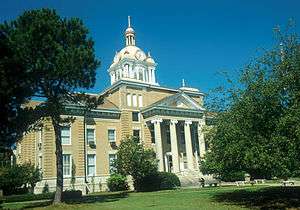 Fayette County courthouse in Fayette | |
 Location within the U.S. state of Alabama | |
 Alabama's location within the U.S. | |
| Coordinates: 33°43′12″N 87°44′19″W | |
| Country | |
| State | |
| Founded | December 20, 1824 |
| Named for | Marquis de Lafayette |
| Seat | Fayette |
| Largest city | Fayette |
| Area | |
| • Total | 629 sq mi (1,630 km2) |
| • Land | 628 sq mi (1,630 km2) |
| • Water | 1.7 sq mi (4 km2) 0.3%% |
| Population (2010) | |
| • Total | 17,241 |
| • Estimate (2019) | 16,302 |
| • Density | 27/sq mi (11/km2) |
| Time zone | UTC−6 (Central) |
| • Summer (DST) | UTC−5 (CDT) |
| Congressional district | 4th |
| |
History
Fayette County was established on December 20, 1824, during Lafayette's historic tour of the 24 United States
Geography
According to the U.S. Census Bureau, the county has a total area of 629 square miles (1,630 km2), of which 628 square miles (1,630 km2) is land and 1.7 square miles (4.4 km2) (0.3%) is water.[3]
Sheriffs Department
Sheriff-Byron Yerby
Adjacent counties
- Marion County (north)
- Walker County (east)
- Tuscaloosa County (southeast)
- Pickens County (southwest)
- Lamar County (west)
Demographics
| Historical population | |||
|---|---|---|---|
| Census | Pop. | %± | |
| 1830 | 3,547 | — | |
| 1840 | 6,942 | 95.7% | |
| 1850 | 9,681 | 39.5% | |
| 1860 | 12,850 | 32.7% | |
| 1870 | 7,136 | −44.5% | |
| 1880 | 10,135 | 42.0% | |
| 1890 | 12,823 | 26.5% | |
| 1900 | 14,132 | 10.2% | |
| 1910 | 16,248 | 15.0% | |
| 1920 | 18,365 | 13.0% | |
| 1930 | 18,443 | 0.4% | |
| 1940 | 21,651 | 17.4% | |
| 1950 | 19,388 | −10.5% | |
| 1960 | 16,148 | −16.7% | |
| 1970 | 16,252 | 0.6% | |
| 1980 | 18,809 | 15.7% | |
| 1990 | 17,962 | −4.5% | |
| 2000 | 18,495 | 3.0% | |
| 2010 | 17,241 | −6.8% | |
| Est. 2019 | 16,302 | [4] | −5.4% |
| U.S. Decennial Census[5] 1790–1960[6] 1900–1990[7] 1990–2000[8] 2010–2018[1] | |||
As of the census[9] of 2010, there were 17,241 people, 7,493 households, and 5,342 families residing in the county. The population density was 30 people per square mile (11/km2). There were 8,472 housing units at an average density of 14 per square mile (5/km2). The racial makeup of the county was 86.92% White, 11.93% Black or African American, 0.21% Native American, 0.15% Asian, 0.01% Pacific Islander, 0.27% from other races, and 0.51% from two or more races. 0.82% of the population were Hispanic or Latino of any race.
As of 2012 the largest self-reported ancestry groups in Fayette County were:
- 44.9% English
- 16.9% "American"
- 4.1% Irish
There were 7,493 households out of which 30.80% had children under the age of 18 living with them, 57.30% were married couples living together, 10.60% had a female householder with no husband present, and 28.70% were non-families. 26.60% of all households were made up of individuals and 13.50% had someone living alone who was 65 years of age or older. The average household size was 2.42 and the average family size was 2.92.
In the county, the population was spread out with 22.30% under the age of 18, 8.20% from 18 to 24, 26.50% from 25 to 44, 25.30% from 45 to 64, and 17.90% who were 65 years of age or older. The median age was 39 years. For every 100 females, there were 93.50 males. For every 100 females age 18 and over, there were 89.60 males.
The median income for a household in the county was $28,539, and the median income for a family was $34,560. Males had a median income of $29,239 versus $20,606 for females. The per capita income for the county was $14,439. About 13.10% of families and 17.90% of the population were below the poverty line, including 22.30% of those under age 18 and 17.90% of those age 65 or over.
Life expectancy
Of 3,143 counties in the United States in 2013, Fayette County ranked 2,882 in the longevity of male residents and 3,091 of female residents. Males in Fayette County lived an average of 71.2 years and females lived an average of 75.3 years compared to the national average for longevity of 76.5 for males and 81.2 for females. The average longevity of men in Fayette County increased by 2.0 years from 1985 to 2013 compared to a national average for the same period of an increased life span for men of 5.5 years. The average longevity, however, for females in Fayette County declined by 4.2 years between 1985 and 2013 compared to the national average for the same period of an increased life span of 3.1 years for women. High rates of smoking and obesity and a low rate of physical activity appear to be contributing factors to the low level of longevity for both sexes.[10]
One study concluded that Fayette County between 1985 and 2010 was one of the few U.S. counties which saw a decline in the longevity of women and that the decline in female longevity in Fayette Country was the largest of any county in the nation.[11]
Education
- Berry High School
- Berry Elementary School
- Fayette County High School
- Fayette Middle School
- Fayette Elementary School
- Hubbertville School
Transportation
Major highways


Airport
Richard Arthur Field (Municipal)- A 5,000 ft (1,500 m) paved runway with JET A and 100LL fuel service. Located about 3 miles (4.8 km) northeast of the city center.
Government
| Year | GOP | Dem | Others |
|---|---|---|---|
| 2016 | 81.4% 6,712 | 16.5% 1,362 | 2.1% 175 |
| 2012 | 76.1% 6,054 | 22.8% 1,817 | 1.1% 87 |
| 2008 | 73.9% 5,883 | 25.1% 1,994 | 1.0% 80 |
| 2004 | 69.2% 5,534 | 30.1% 2,408 | 0.8% 60 |
| 2000 | 58.7% 4,582 | 39.2% 3,064 | 2.1% 162 |
| 1996 | 44.3% 3,191 | 46.9% 3,381 | 8.8% 637 |
| 1992 | 42.6% 3,604 | 45.2% 3,830 | 12.2% 1,036 |
| 1988 | 57.4% 4,338 | 42.2% 3,186 | 0.4% 33 |
| 1984 | 64.6% 4,654 | 35.2% 2,533 | 0.2% 14 |
| 1980 | 48.8% 3,315 | 49.9% 3,389 | 1.3% 85 |
| 1976 | 34.4% 2,165 | 64.8% 4,076 | 0.7% 46 |
| 1972 | 83.5% 4,240 | 16.5% 836 | 0.0% 0 |
| 1968 | 13.3% 827 | 10.8% 676 | 75.9% 4,735 |
| 1964 | 71.3% 3,203 | 28.7% 1,287 | |
| 1960 | 45.7% 1,923 | 54.1% 2,274 | 0.2% 8 |
| 1956 | 49.6% 1,948 | 49.8% 1,956 | 0.6% 24 |
| 1952 | 39.2% 1,481 | 60.5% 2,287 | 0.3% 11 |
| 1948 | 35.8% 580 | 64.2% 1,042 | |
| 1944 | 35.5% 913 | 64.1% 1,648 | 0.4% 10 |
| 1940 | 25.9% 737 | 73.4% 2,091 | 0.7% 20 |
| 1936 | 24.4% 732 | 74.8% 2,244 | 0.8% 23 |
| 1932 | 26.5% 733 | 72.7% 2,013 | 0.8% 23 |
| 1928 | 59.8% 1,686 | 40.1% 1,131 | 0.0% 1 |
| 1924 | 41.3% 977 | 57.4% 1,358 | 1.4% 33 |
| 1920 | 56.4% 1,865 | 42.7% 1,413 | 0.9% 31 |
| 1916 | 39.7% 697 | 58.4% 1,026 | 1.9% 33 |
| 1912 | 28.5% 434 | 50.1% 762 | 21.4% 326 |
| 1908 | 43.8% 678 | 47.2% 731 | 9.0% 139 |
| 1904 | 39.4% 599 | 46.9% 712 | 13.7% 208 |
Communities
Cities
- Fayette (county seat)
- Winfield (partly in Marion County)
Towns
- Belk
- Berry
- Glen Allen (partly in Marion County)
- Gu-Win (partly in Marion County)
Unincorporated communities
See also
References
- "State & County QuickFacts". United States Census Bureau. Archived from the original on May 17, 2014. Retrieved May 16, 2014.
- Gannett, Henry (1905). The Origin of Certain Place Names in the United States. Govt. Print. Off. p. 124.
- "2010 Census Gazetteer Files". United States Census Bureau. August 22, 2012. Retrieved August 22, 2015.
- "Population and Housing Unit Estimates". Retrieved May 21, 2019.
- "U.S. Decennial Census". United States Census Bureau. Retrieved August 22, 2015.
- "Historical Census Browser". University of Virginia Library. Retrieved August 22, 2015.
- Forstall, Richard L., ed. (March 24, 1995). "Population of Counties by Decennial Census: 1900 to 1990". United States Census Bureau. Retrieved August 22, 2015.
- "Census 2000 PHC-T-4. Ranking Tables for Counties: 1990 and 2000" (PDF). United States Census Bureau. April 2, 2001. Retrieved August 22, 2015.
- "U.S. Census website". United States Census Bureau. Retrieved May 14, 2011.
- "Fayette County, Alabama", http://www.healthdata.org/sites/default/files/files/county_profiles/US/County_Report_Fayette_County_Alabama.pdf Archived 2016-04-14 at the Wayback Machine, accessed October 12, 2016
- Wang et al, "Population Health Metrics", 2013, 11:8, http://www.pophealthmetrics.com/content/11/1/8, accessed October 13, 2016
- "Dave Leip's Atlas of U.S. Presidential Elections". Retrieved November 16, 2016.
External links
Places adjacent to Fayette County, Alabama | ||||||||||
|---|---|---|---|---|---|---|---|---|---|---|
| ||||||||||
Municipalities and communities of Fayette County, Alabama, United States | ||
|---|---|---|
| Cities | Map of Alabama highlighting Fayette County | |
| Towns | ||
| Unincorporated communities | ||
| Footnotes | ‡This populated place also has portions in an adjacent county or counties | |
Montgomery (capital) | ||
| Topics | ||
| Society |
| |
| Regions | ||
| Flora and fauna | ||
| Largest cities | ||
| Metros |
| |
| Counties |
| |

| Authority control |
|
|---|