List of districts of Nepal
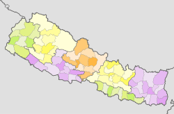
Districts in Nepal are second level of administrative divisions after provinces. Districts are subdivided in municipalities and rural municipalities. There are seven provinces and 77 districts in Nepal.
| District | |
|---|---|
| Also known as: जिल्ला | |
| Category | Jilla |
| Location | Nepal |
| Created | pre 1816 |
| Number | 77 (as of 20 September 2015) |
| Populations | 1,744,240 – 6,538 |
| Areas | 7,889 square kilometres (3,046 sq mi) - 119 square kilometres (46 sq mi) |
| Government | District Coordination Committee |
| Subdivisions | Urban Municipality Rural Municipality |
 |
|---|
| This article is part of a series on the politics and government of Nepal |
Executive:
Federal Parliament:
Judiciary:
|
|
Administrative divisions
|
|
|
|
Related topics |
|
|
| This article is part of a series on |
| Administrative divisions of Nepal |
|---|
 |
| Federal Democratic Republic of Nepal (Since 2015) |
|
Provinces: 7 (First level) |
|
Districts: 77 (Second level) |
|
Local level body: 753 (Third level)
|
|
Wards: 6743 (last level)
|
| Kingdom of Nepal (1768-2008) |
|
Development regions: 5 (First level)
|
|
Zones of Nepal: 14 (Second level) Mechi Zone • Kosi Zone • Sagarmatha Zone • Janakpur Zone • Bagmati Zone • Narayani Zone • Gandaki Zone • Lumbini Zone • Dhaulagiri Zone • Rapti Zone • Karnali Zone • Bheri Zone • Seti Zone • Mahakali Zone |
|
Districts: 75 (Third level)
|
|
VDC:3157 (fourth level) |
|
Wards (last level)
|
|
Nepal Portal Administrative divisions by country |
After the state's reconstruction of administrative divisions, Nawalparasi District and Rukum District were divided into Parasi District and Nawalpur District, and Eastern Rukum District and Western Rukum District respectively.
District official include:
- Chief District Officer, an official under Ministry of Home Affairs is appointed by the government as the highest administrative officer in a district. The C.D.O is responsible for proper inspection of all the departments in a district such as health, education, security and all other government offices.
- District Coordination Committee acts as an executive to the District Assembly. The DCC coordinates with the Provincial Assembly to establish coordination between the Provincial Assembly and rural municipalities and municipalities and to settle disputes, if any, of political nature. It also maintains coordination between the provincial and Federal government and the local bodies in the district.
History
During the time of king Rajendra Bir Bikram Shah and prime minister Bhimsen Thapa, Nepal was divided into 10 districts.[1] All areas east of Dudhkoshi River were one district, Dhankuta.
Rana regime (1885–1950): During the time of prime minister Bir Shumsher Jang Bahadur Rana (1885-1901) Nepal was divided into 32 districts and Doti, Palpa and Dhankuta were 3 gaunda (Nepali: गौंडा) (english meaning: Cantonment). Hilly region had 20 districts and Terai had 12 districts.[1]
Even after Bir Shumsher Jang Bahadur Rana to the end of Rana rule in Nepal in 1951 and till the proclamation of new constitution of Kingdom of Nepal in 1962, Nepal remained divided into 32 districts. Each had a headquarters and Bada Haqim (District Administrator) as its head. From 1951 to 1962 many acts and constitutions passed which shows name of districts as below:[2][3][4]
Districts Before 1956
|
|
|
|
Districts from 1956 to 1962
|
|
|
|
Panchayat era (1960–1990):
In 1962, the reorganisation of traditional 32 districts into 14 zones and 75 development Districts.[5]
District Panchayat was one of the four administrative divisions of Nepal during the Panchayat System (1962–1990). During the Panchayat time the country was divided into 75 districts and now 2 districts are added by dividing Nawalparasi and Rukum into 2 districts. Now the total number of districts is 77.
District Development Committee (1990–2015):
Composed of elected members at the district level. It was responsible for formulating district-level development policies. It was established in 1990, following the end of the Panchayat system.
Districts under new administration
As of 20 September 2015 Nepal is divided into 7 provinces. They are defined by schedule 4 of the new constitution, by grouping together the existing districts. Two districts, Rukum and Nawalparasi, are split in two parts ending up in two different provinces.[6] The old District Development Committee (DDC) replaced with District Coordination Committee (DCC).
Overview
| S.N. | Map | Provinces | Capital | Districts | Area (KM²) |
Population (2011) |
Density (people/KM²) |
Official Languages |
|---|---|---|---|---|---|---|---|---|
| Nepal | Kathmandu | 77 | 147,181 KM² | 26,494,504 | 180 | Nepali | ||
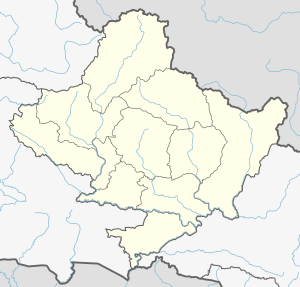
| 1 | 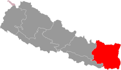 | Province No. 1 | Biratnagar | 14 | 25,905 KM² | 4,534,943 | 175 | Nepali/Bantawa/Maithili/Limbu |
| 2 | 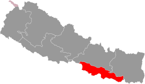 | Province No. 2 | Janakpur | 8 | 9,661 KM² | 5,404,145 | 559 | Nepali/Maithili/Bhojpuri |
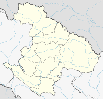
| 3 |  | Bagmati Pradesh | Hetauda | 13 | 20,300 KM² | 5,529,452 | 272 | Nepali/Tamang/Nepal Bhasha |
| 4 | 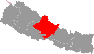 | Gandaki Pradesh | Pokhara | 11 | 21,504 KM² | 2,413,907 | 112 | Nepali/Gurung/Magar |
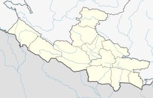
| 5 | 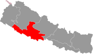 | Province No. 5 | Butwal | 12 | 22,288 KM² | 4,891,025 | 219 | Nepali/Tharu/Awadhi |
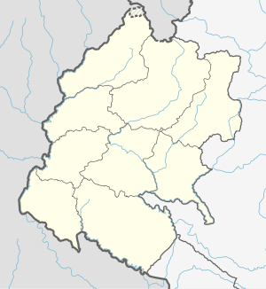
| 6 | 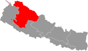 | Karnali Pradesh | Birendranagar | 10 | 27,984 KM² | 1,168,515 | 41 | Nepali/Magar/Tamang |
| 7 | 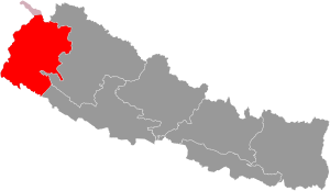 | Sudurpashchim Pradesh | Godawari | 9 | 19,539 KM² | 2,552,517 | 130 | Nepali/Doteli/Tharu |
List of districts by province
Province No. 1
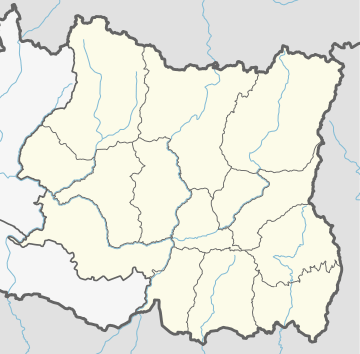
khumbu
sabha
| Name | Nepali | Headquarters | Area (km²) | Population (2011) | Website |
|---|---|---|---|---|---|
| Bhojpur District | भोजपुर जिल्ला | Bhojpur | 1,507 | 182,459 | |
| Dhankuta District | धनकुटा जिल्ला | Dhankuta | 892 | 163,412 | |
| Ilam District | इलाम जिल्ला | Ilam | 1,703 | 290,254 | |
| Jhapa District | झापा जिल्ला | Bhadrapur | 1,606 | 812,650 | |
| Khotang District | खोटाँग जिल्ला | Diktel | 1,591 | 206,312 | |
| Morang District | मोरंग जिल्ला | Biratnagar | 1,855 | 965,370 | |
| Okhaldhunga District | ओखलढुंगा जिल्ला | Siddhicharan | 1,074 | 147,984 | |
| Panchthar District | पांचथर जिल्ला | Phidim | 1,241 | 191,817 | |
| Sankhuwasabha District | संखुवासभा जिल्ला | Khandbari | 3,480 | 158,742 | |
| Solukhumbu District | सोलुखुम्बू जिल्ला | Salleri | 3,312 | 105,886 | |
| Sunsari District | सुनसरी जिल्ला | Inaruwa | 1,257 | 763,497 | |
| Taplejung District | ताप्लेजुंग जिल्ला | Taplejung | 3,646 | 127,461 | |
| Terhathum District | तेह्रथुम जिल्ला | Myanglung | 679 | 113,111 | |
| Udayapur District | उदयपुर जिल्ला | Gaighat | 2,063 | 317,532 | |
| Province No. 1 | प्रदेश नं० १ | Biratnagar | 25,905 km2 | 4,534,943 |
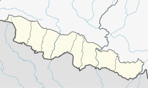
Province No. 2
| Districts | Nepali | Headquarters | Area (km2) | Population (2011)[7] | Official Website |
|---|---|---|---|---|---|
| Parsa District | पर्सा जिल्ला | Birganj | 1,353 | 601,017 | |
| Bara District | बारा जिल्ला | Kalaiya | 1,190 | 687,708 | |
| Rautahat District | रौतहट जिल्ला | Gaur | 1,126 | 686,723 | |
| Sarlahi District | सर्लाही जिल्ला | Malangwa | 1,259 | 769,729 | |
| Dhanusa District | धनुषा जिल्ला | Janakpur | 1,180 | 754,777 | |
| Siraha District | सिराहा जिल्ला | Siraha | 1,188 | 637,328 | |
| Mahottari District | महोत्तरी जिल्ला | Jaleshwar | 1,002 | 627,580 | |
| Saptari District | सप्तरी जिल्ला | Rajbiraj | 1,363 | 639,284 | |
| Province No. 2 | प्रदेश नं० २ | Janakpur | 9,661 km2 | 5,404,416 |
Bagmati Pradesh
| Districts | Nepali | Headquarters | Area (km2.) | Population (2011)[7] | Official Website |
|---|---|---|---|---|---|
| Sindhuli District | सिन्धुली जिल्ला | Kamalamai | 2,491 | 296,192 | |
| Ramechhap District | रामेछाप जिल्ला | Manthali | 1,546 | 202,646 | |
| Dolakha District | दोलखा जिल्ला | Bhimeshwar | 2,191 | 186,557 | |
| Bhaktapur District | भक्तपुर जिल्ला | Bhaktapur | 119 | 304,651 | |
| Dhading District | धादिङ जिल्ला | Nilkantha | 1,926 | 336,067 | |
| Kathmandu District | काठमाडौँ जिल्ला | Kathmandu | 395 | 1,744,240 | |
| Kavrepalanchok District | काभ्रेपलान्चोक जिल्ला | Dhulikhel | 1,396 | 381,937 | |
| Lalitpur District | ललितपुर जिल्ला | Lalitpur | 385 | 468,132 | |
| Nuwakot District | नुवाकोट जिल्ला | Bidur | 1,121 | 277,471 | |
| Rasuwa District | रसुवा जिल्ला | Dhunche | 1,544 | 43,300 | |
| Sindhupalchok District | सिन्धुपाल्चोक जिल्ला | Chautara | 2,542 | 287,798 | |
| Chitwan District | चितवन जिल्ला | Bharatpur | 2,218 | 579,984 | |
| Makwanpur District | मकवानपुर जिल्ला | Hetauda | 2,426 | 420,477 | |
| Bagmati Pradesh | वाग्मती प्रदेश | Hetauda | 20,300 km² | 5,529,452 |
Gandaki Pradesh
| Districts | Nepali | Headquarters | Area (km2.) | Population (2011)[7] | Official Website |
|---|---|---|---|---|---|
| Baglung District | बागलुङ जिल्ला | Baglung | 1,784 | 268,613 | |
| Gorkha District | गोरखा जिल्ला | Gorkha | 3,610 | 271,061 | |
| Kaski District | कास्की जिल्ला | Pokhara | 2,017 | 492,098 | |
| Lamjung District | लमजुङ जिल्ला | Besisahar | 1,692 | 167,724 | |
| Manang District | मनाङ जिल्ला | Chame | 2,246 | 6,538 | |
| Mustang District | मुस्ताङ जिल्ला | Jomsom | 3,573 | 13,452 | |
| Myagdi District | म्याग्दी जिल्ला | Beni | 2,297 | 113,641 | |
| Nawalpur District | नवलपुर जिल्ला | Kawasoti | 1,043.1 | 310,864 | |
| Parbat District | पर्वत जिल्ला | Kusma | 494 | 146,590 | |
| Syangja District | स्याङग्जा जिल्ला | Putalibazar | 1,164 | 289,148 | |
| Tanahun District | तनहुँ जिल्ला | Damauli | 1,546 | 323,288 | |
| Gandaki Pradesh | गण्डकी प्रदेश | Pokhara | 21,733 km² | 2,403,757 |
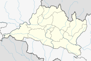
Province No. 5
Rukum
| Districts | Nepali | Headquarters | Area (km2.) | Population (2011)[7] | Official Website |
|---|---|---|---|---|---|
| Kapilvastu District | कपिलवस्तु जिल्ला | Taulihawa | 1,738 | 571,936 | |
| Parasi District | परासी जिल्ला | Ramgram | 634.88 | 321,058 | |
| Rupandehi District | रुपन्देही जिल्ला | Siddharthanagar | 1,360 | 880,196 | |
| Arghakhanchi District | अर्घाखाँची जिल्ला | Sandhikharka | 1,193 | 197,632 | |
| Gulmi District | गुल्मी जिल्ला | Tamghas | 1,149 | 280,160 | |
| Palpa District | पाल्पा जिल्ला | Tansen | 1,373 | 261,180 | |
| Dang Deukhuri District | दाङ देउखुरी जिल्ला | Ghorahi | 2,955 | 552,583 | |
| Pyuthan District | प्युठान जिल्ला | Pyuthan | 1,309 | 228,102 | |
| Rolpa District | रोल्पा जिल्ला | Liwang | 1,879 | 224,506 | |
| Eastern Rukum District | पूर्वी रूकुम जिल्ला | Rukumkot | 1,161.13 | 53,018 | |
| Banke District | बाँके जिल्ला | Nepalganj | 2,337 | 491,313 | |
| Bardiya District | बर्दिया जिल्ला | Gulariya | 2,025 | 426,576 | |
| Province No. 5 | प्रदेश नं. ५ | Butwal | 22,288 km² | 4,499,272 |
Karnali Pradesh
west
| Districts | Nepali | Headquarters | Area (km2) | Population (2011)[7] | Official Website |
|---|---|---|---|---|---|
| Western Rukum District | पश्चिमी रूकुम जिल्ला | Musikot | 1,213.49 | 154,272 | |
| Salyan District | सल्यान जिल्ला | Salyan | 1,462 | 242,444 | |
| Dolpa District | डोल्पा जिल्ला | Dunai | 7,889 | 36,700 | |
| Humla District | हुम्ला जिल्ला | Simikot | 5,655 | 50,858 | |
| Jumla District | जुम्ला जिल्ला | Chandannath | 2,531 | 108,921 | |
| Kalikot District | कालिकोट जिल्ला | Manma | 1,741 | 136,948 | |
| Mugu District | मुगु जिल्ला | Gamgadhi | 3,535 | 55,286 | |
| Surkhet District | सुर्खेत जिल्ला | Birendranagar | 2,451 | 350,804 | |
| Dailekh District | दैलेख जिल्ला | Narayan | 1,502 | 261,770 | |
| Jajarkot District | जाजरकोट जिल्ला | Khalanga | 2,230 | 171,304 | |
| Karnali Pradesh | कर्णाली प्रदेश | Birendranagar | 27,984 km² | 1,570,418 |
Sudurpashchim Pradesh
| Districts | Nepali | Headquarters | Area (km2) | Population (2011)[7] | Official Website |
|---|---|---|---|---|---|
| Kailali District | कैलाली जिल्ला | Dhangadhi | 3,235 | 775,709 | |
| Achham District | अछाम जिल्ला | Mangalsen | 1,680 | 257,477 | |
| Doti District | डोटी जिल्ला | Dipayal Silgadhi | 2,025 | 211,746 | |
| Bajhang District | बझाङ जिल्ला | Jayaprithvi | 3,422 | 195,159 | |
| Bajura District | बाजुरा जिल्ला | Martadi | 2,188 | 134,912 | |
| Kanchanpur District | कंचनपुर जिल्ला | Bhimdatta | 1,610 | 451,248 | |
| Dadeldhura District | डडेलधुरा जिल्ला | Amargadhi | 1,538 | 142,094 | |
| Baitadi District | बैतडी जिल्ला | Dasharathchand | 1,519 | 250,898 | |
| Darchula District | दार्चुला जिल्ला | Darchula | 2,322 | 133,274 | |
| Sudurpashchim Pradesh | सुदूर-पश्चिम प्रदेश | Godawari | 19,539 km² | 2,552,517 |
See also
- Provinces of Nepal
- Development Regions of Nepal (former)
- List of zones of Nepal (former)
- List of village development committees of Nepal (former)
References
- "संक्षिप्त परिचय" [Short Intro]. ddcdhankuta.gov.np (in Nepali). Govt of Nepal. Retrieved 6 February 2018.
..."श्री ५ राजेन्द्रविक्रम शाह र प्रधानमन्त्री भीमसेन थापाको शासनकालमा प्रशासनिक दृष्टिकोणले वि.सं.१८७३ साल पश्चात देश १० जिल्लामा विभाजन भयो।"
- "Government of Nepal Act 1948" (PDF).
- "प्रशासकीय पुनर्गठन समिति (बुच कमिशन) को प्रतिवेदन, २००९" (PDF).
- "नेपालको जिल्ला प्रशासन पुनर्गठनको रिपोर्ट, २०१३" (PDF).
- "Memorial Step of King Mahendra in 1st Poush 2017 BS". reviewnepal.com. 13 December 2017. Retrieved 6 February 2018.
..." "
- "There will be 77 districts in the country: Minister Thapa". myrepublica.com. 6 August 2017. Retrieved 13 September 2017.
- 2011 Census District Level Detail Report Archived 2018-09-02 at the Wayback Machine, Central Bureau of Statistics.
External links
| Wikimedia Commons has media related to Districts of Nepal. |
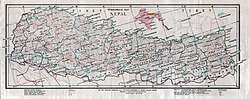
- Digitalhimalaya.com: Collection of Nepalese District maps — from the Digital Himalaya database project.
- Myholidaynepal.com: Places of Nepal