Nepalgunj
Nepalgunj ([nepaːlɡəndʒ]), also spelled Nepalganj, is a Sub-Metropolitan City in Banke District, Nepal. It lies on the Terai plains near the southern border with Bahraich district in Uttar Pradesh, India. Nepalgunj is 153 kilometers south-west of Ghorahi and 16 km south of Kohalpur. Former Village Development Committee: Udayapur, Bhawaniyapur, Piprahawa, Jaispur, Paraspur, Indrapur, Khaskarkado, Bashudevpur, Manikapur and Puraina were added to territory in order to make it Sub metropolitan city on 2071 Paush 28 and later Puraini was also added in list on 2072 Paush 21. Further, while restructuring of local levels nationwide, ward no. 23 (former Indrapur VDC) was taken out to Janaki Rural Municipality and ward no. 7 of Hirminiya VDC was added to Nepalgunj.<Bishnu Pasa> is famous in Nepalgunj
Nepalgunj | |
|---|---|
 Nepalgunj 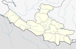 Nepalgunj | |
| Coordinates: 28°03′N 81°37′E | |
| Country | |
| Province | Province No. 5[1] |
| Zone | Bheri |
| District | Banke |
| Government | |
| • Type | Mayor–council |
| • Mayor | Dhawal Shamsher JBR[2] (RPP) |
| • Deputy Mayor | Uma Thapa Magar (NC)[2] |
| • Executive Officer | Bhim Bahadur Kunwar |
| Area | |
| • Total | 85.94 km2 (33.18 sq mi) |
| Elevation | 150 m (490 ft) |
| Population (2011) | |
| • Total | 73,779 |
| • Density | 1,616.84/km2 (4,187.6/sq mi) |
| Time zone | UTC+5:45 (NST) |
| Area code(s) | 081 |
| Website | www.nepalgunjmun.gov.np |
Overview
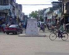
The Dhamboji neighborhood is the center of the city and main business hub. The 24 km long Surkhet Road runs through the middle of the city.
Demographics
The 2011 census counted 73,779 inhabitants, with 20% growth since 2001.[3] Nepali is spoken natively by Paharis as well as by people of other ethnicities as the national language and lingua franca. The mother tongue for the native inhabitants is still Awadhi, which is understood and normally spoken by the entire population of the district.
Culture and religion
Nepalgunj has a diverse culture with people from different faiths living within mixed communities. Hinduism and Islam are two major religions in the city, with Hindus comprising the larger percentage of the population. The city also has followers of other religions like Buddhism, Sikhism and Christianity. People of different ethnicity are known to have traditionally lived together, without any significant conflicts. Muslim have grown in unprecedented numbers in the region.
However, recent conflict occurred in December 2006 between the Pahari people and the Madhesi people, following immediately after the 2006 democracy movement in Nepal. The conflict resulted in the death of at least one person, while dozens of others were injured.
Transport

Nepalgunj Airport is located 6 km north of the city centre. The airport was officially named Mahendra Airport after the late King Mahendra, but it is commonly referred to as Ranjha Airport. It operated flights to Kathmandu and to airports in less developed western districts such as Dolpa, Jumla, Mugu and Rukum.
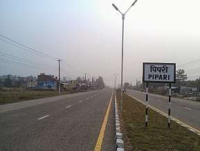
Nepalgunj has bus and mini-bus services. The country's longest highway, Mahendra Highway, runs through the town of Kohalpur, 10 kilometers from Nepalgunj city center.
An Indian Railways line reaches Rupaidiha across the border. It involves train changes at Gonda, Bahraich and Nanpara. For travellers coming in from India it is also possible to take an express train to Lucknow and from there a direct bus to Rupaidiha. Indian and Nepalese nationals may cross the border without restrictions; however, there is a customs checkpoint for goods and third country nationals.
Infrastructure
- Bheri Zonal Hospital
- Nepalgunj Medical College Teaching Hospital
Education
Nepalgunj has several boarding and government-run schools. Mahendra Multiple Campus is the largest public higher-level institution in the district, and is affiliated to Tribhuvan University. The following is a list of secondary and higher-level academic institutions in the city.
- ABC Residential Higher Secondary School
- Angels High School
- Adarsh Higher Secondary School
- Brightland Higher Secondary School
- Bheri Vidhya Mandir
- British English Boarding School
- City College of Management
- City Public High School
- College of Engineering and Management
- Dream Land Secondary School
- GVN Higher Secondary School
- Golden ABC High School
- Holy Land Higher Secondary School
- Jaya Bageshwori H.S. School
- Junior Cambridge Higher Secondary School
- Jaycees Bal Sansar E.M. School
- Lotus English Medium School
- Mahendra Model Higher Secondary School
- Mahendra Multiple Campus
- Maithawa higher secondary school
- Modern Public Higher Secondary School
- Muntara Secondary School
- Shree Sharada Lower secondary school nepalgunj-10, Banke
- Nepalgunj Medical College
- Nepalgunj Multiple Campus (NMC)
- Nepalgunj Technical College
- National Engineering College
- Pashupati Higher Secondary School
- Shree Buddha English Medium School
- Shree Shaileshwori Vidhya Niketan
- St. Thomas Higher Secondary School
- United Educational Academy
- West Zone E. M. Higher Secondary School
- Nepalgunj Model Academy
- Bheri English Medium High School
- Sun Beam Higher Secondary School
- Shanti Bidhya Niketan
- Dhumbojhi Higher Secondary School
- Gorkha School
- Nepalgunj Model Academy
- Deep Jyoti Vidyashram Secondary School
- Saraswati secondary school
- Shree Ma.Vi. Bhawaniyapur
- Narayan High school
- Mahendra High School
- Mangal Prasad High School
Communications
- A post office is located at Charbahini Chok
- Telephone networks (land lines) including telephone exchange systems.
- Mobile phone networks.
- Cable television physical networks including receiving stations and cable distribution networks.
- Internet Services (Several cyber cafes, private and Governmental ISPs are present)
Climate
Nepalgunj has a sub-tropical climate. Temperatures sometimes exceed 40°C (104°F) from April to June. During the rainy season—arriving in June and lasting into September—it is less hot but sometimes very humid. Winter is usually pleasant while the sun is out. It sometimes is foggy and overcast; then it can be chilly with temperatures below 10°C (41°F) but no frost. The highest temperature ever recorded in Nepalgunj was 45.0 °C (113.0 °F) on 16 June 1995, while the lowest temperature ever recorded was −0.3 °C (31.5 °F) on 9 January 2013.[4]
| Climate data for Nepalgunj 144m (1981-2010) | |||||||||||||
|---|---|---|---|---|---|---|---|---|---|---|---|---|---|
| Month | Jan | Feb | Mar | Apr | May | Jun | Jul | Aug | Sep | Oct | Nov | Dec | Year |
| Average high °C (°F) | 20.9 (69.6) |
25.2 (77.4) |
30.9 (87.6) |
36.5 (97.7) |
37.4 (99.3) |
36.5 (97.7) |
33.3 (91.9) |
33.0 (91.4) |
32.5 (90.5) |
31.5 (88.7) |
28.0 (82.4) |
23.4 (74.1) |
30.8 (87.4) |
| Daily mean °C (°F) | 14.9 (58.8) |
18.4 (65.1) |
23.3 (73.9) |
28.6 (83.5) |
31.0 (87.8) |
31.5 (88.7) |
29.8 (85.6) |
29.7 (85.5) |
28.8 (83.8) |
26.1 (79.0) |
21.6 (70.9) |
17.0 (62.6) |
25.1 (77.2) |
| Average low °C (°F) | 9.0 (48.2) |
11.6 (52.9) |
15.8 (60.4) |
20.8 (69.4) |
24.6 (76.3) |
26.4 (79.5) |
26.4 (79.5) |
26.4 (79.5) |
25.1 (77.2) |
20.8 (69.4) |
15.1 (59.2) |
10.5 (50.9) |
19.4 (66.9) |
| Average precipitation mm (inches) | 22.8 (0.90) |
24.3 (0.96) |
14.9 (0.59) |
16.3 (0.64) |
71.4 (2.81) |
199.4 (7.85) |
430.7 (16.96) |
353.8 (13.93) |
235.2 (9.26) |
58.3 (2.30) |
5.1 (0.20) |
11.7 (0.46) |
1,443.9 (56.85) |
| Source: Department Of Hydrology and Meteorology[5] | |||||||||||||
Hotels
With the boost in the tourism industry after the change in political scenario of Nepal in the 1950s, the hotel and restaurant industries in Nepalgunj have experienced significant growth. The Sneha Hotel features in the atmospheric travel memoir A Glimpse of Eternal Snows by Jane Wilson-Howarth.[6]
Places of interest
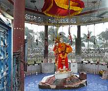
- Bageshwari Temple
- Banke National Park
- Manpur Mainapokhar is half an hour drive to travel Badhiya Lake
- Bardia National Park is an hour's drive west
- Karnali River is 90 minutes drive west
- Tharu villages in Deukhuri Valley to the west along the east-west highway
- Surkhet, an Inner Terai Valley north of Nepalgunj.
Sports
Cricket and association football are the two most popular sports in Nepalgunj. Most of the city's big sports tournaments are held in the city's football stadium and gymnasium. As of September 2011, an international cricket stadium is under construction in Kohalpur.[7]
Media
Two cinema halls, Laxmi hall and QFX Bageshwori, can be found in Nepalgunj. The city also has several community radio stations:
- Radio Himal 92.6 MHz
- Nepalgunj Community FM 104.8 MHz
- Bheri FM 105.4 MHz
- Radio Krishnasar 94 MHz
- Radio Bageshwori 94.6 MHz
- Bheri Awaj FM 95.6 MHz
- Morning Star 90.0 MHz
See also
- Ghorahi, Nepal
- Kohalpur
- [[Manpur Mainapokhar]
References
- "Protests, clashes in Province 5 districts over demarcations".
- "Nepalgunj electorate elect RPP candidate Rana as mayor again".
- "Nepal: Provinces, Zones, Districts, Cities, Urban Municipalities - Population Statistics in Maps and Charts". www.citypopulation.de. Retrieved 27 August 2019.
- "Archived copy" (PDF). Archived from the original (PDF) on 4 March 2016. Retrieved 27 February 2016.CS1 maint: archived copy as title (link). Retrieved 27 February 2016.
- . Department Of Hydrology and Meteorology Retrieved 26 September 2014.
- Jane Wilson-Howarth (2012). A Glimpse of Eternal Snows: a journey of love and loss in the Himalayas. Bradt Travel Guides, UK. p. 390. ISBN 978-1-84162-435-8.
- "International Cricket ground under delay | Cricnepal.com". cricnepal.com. 26 September 2011. Retrieved 15 February 2017.
External links
| Wikimedia Commons has media related to Nepalganj. |
| Wikivoyage has a travel guide for Nepalgunj. |
Headquarters: Nepalgunj | ||
| Sub-metropolitan cities |  | |
| Municipalities | ||
| Rural munticipalities |
| |
| Former VDCs |
| |
List of municipalities and rural municipalities of Nepal | ||