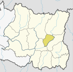
Tehrathum District
Tehrathum District (Nepali: तेह्रथुम जिल्ला![]()
| Climate Zone[1] | Elevation Range | % of Area |
|---|---|---|
| Upper Tropical | 300 to 1,000 meters 1,000 to 3,300 ft. |
24.0% |
| Subtropical | 1,000 to 2,000 meters 3,300 to 6,600 ft. |
56.4% |
| Temperate | 2,000 to 3,000 meters 6,400 to 9,800 ft. |
19.5% |
Tehrathum District तेह्रथुम | |
|---|---|
District | |
 | |
| Country | |
| Province | Province No. 1 |
| Admin HQ. | Myanglung |
| Government | |
| • Type | Coordination committee |
| • Body | DCC, Tehrathum |
| Area | |
| • Total | 679 km2 (262 sq mi) |
| Time zone | UTC+05:45 (NPT) |
| Website | ddctehrathum.gov.np |
Demographics
At the time of the 2011 Nepal census, Tehrathum District had a population of 101,577. Of these, 49.8% spoke Nepali, 34.4% Limbu, 6.0% Tamang, 2.2% Magar, 1.9% Gurung, 1.4% Newari, 1.4% Rai, 1.0% Sherpa and 0.6% Kulung as their first language.
46.7% of the population in the district spoke Nepali, 1.0% Limbu and 1.0% Bantawa as their second language.[2]
See also
- Radio Tehrathum
- Zones of Nepal
- Radio Menchhyayem
References
- The Map of Potential Vegetation of Nepal - a forestry/agroecological/biodiversity classification system (PDF), Forest & Landscape Development and Environment Series 2-2005 and CFC-TIS Document Series No.110., 2005, ISBN 87-7903-210-9, retrieved Nov 22, 2013
- 2011 Nepal Census, Social Characteristics Tables
- "Districts of Nepal". Statoids.
External links
| Wikimedia Commons has media related to Terhathum District. |
Places adjacent to Tehrathum District | ||||||||||
|---|---|---|---|---|---|---|---|---|---|---|
| ||||||||||
Terhathum District | ||
|---|---|---|
Headquarter: Myanglung | ||
| Rural Municipalities | | |
| Municipalities | ||
This article is issued from Wikipedia. The text is licensed under Creative Commons - Attribution - Sharealike. Additional terms may apply for the media files.