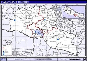
Makwanpur District
Makwanpur District(Nepali: मकवानपुर जिल्ला![]()
Makawanpur District मकवानपुर | |
|---|---|
District | |
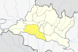 Location of district in province | |
| Country | |
| Province | Bagmati Pradesh |
| Admin HQ. | Hetauda |
| Government | |
| • Type | Coordination committee |
| • Body | DCC, Makawanpur |
| Area | |
| • Total | 2,426 km2 (937 sq mi) |
| Population (2011)[1] | |
| • Total | 420,477 |
| • Density | 170/km2 (450/sq mi) |
| Time zone | UTC+05:45 (NPT) |
| Main Language(s) | Nepali |
| Website | www.ddcmakwanpur.gov.np |
History
During Rana regime, the district was named Chisapani District and the headquarter of the district was situated in Chisapanigadhi. The district renamed as Makwanpur on the name of Makwanpurgadhi and the headquarter moved to Hetauda in 1982.
Geography and Climate
| Climate Zone[2] | Elevation Range | % of Area |
|---|---|---|
| Lower Tropical | below 300 meters (1,000 ft) | 7.2% |
| Upper Tropical | 300 to 1,000 meters 1,000 to 3,300 ft. |
59.0% |
| Subtropical | 1,000 to 2,000 meters 3,300 to 6,600 ft. |
28.9% |
| Temperate | 2,000 to 3,000 meters 6,400 to 9,800 ft. |
4.9% |
Demographics
At the time of the 2011 Nepal census, Makwanpur District had a population of 420,477. Of these, 45.3% spoke Tamang, 41.9% Nepali, 4.0% Newari, 3.8% Chepang, 1.3% Magar, 1.0% Bhojpuri, 0.7% Maithili and 0.5% Rai as their first language.
54.0% of the population in the district spoke Nepali as their second language.[3]
Administration
The district consists of 10 Municipalities, out of which one is a sub-metropolitan city, one is an urban municipality and eight are rural municipalities. These are as follows:[4]
- Hetauda Sub-Metropolitan City
- Thaha Municipality
- Bhimphedi Rural Municipality
- Makawanpurgadhi Rural Municipality
- Manahari Rural Municipality
- Raksirang Rural Municipality
- Bakaiya Rural Municipality
- Bagmati Rural Municipality
- Kailash Rural Municipality
- Indrasarowar Rural Municipality
Former Village Development Committees and Municipalities
- Agara
- Ambhanjyang
- Bajrabarahi
- Betini
- Bhainse
- Bharta Pundyadevi
- Bhimphedi
- Budhichaur
- Chhatiwan
- Chitlang
- Dandakharka
- Dhimal
- Gogane
- Handikhola
- Hetauda (Sub metropolitan city)
- Hurnamadi
- Ipa Panchakanya
- Kalikatar
- Kankada
- Kamane
- Khairang
- Kogate
- Kulekhani
- Makwanpurgadhi
- Manahari
- Manthali
- Markhu
- Marta Punchedevi
- Namtar
- Nibuwatar
- Fakhel
- Phaparbari
- Raigaun
- Raksirang
- Sarikhet Palase
- Shikharpur
- Sripur Chhatiwan
- Sisneri Mahadevsthan
- Sukaura
- Thaha Municipality
- Thingan
- Tistung Deurali
References
- General Bureau of Statistics, Kathmandu, Nepal, Nov. 2012
- The Map of Potential Vegetation of Nepal - a forestry/agroecological/biodiversity classification system (PDF), Forest & Landscape Development and Environment Series 2-2005 and CFC-TIS Document Series No.110., 2005, ISBN 87-7903-210-9, retrieved Nov 22, 2013
- 2011 Nepal Census, Social Characteristics Tables
- "स्थानिय तह" (in Nepali). Ministry of Federal Affairs and General Administration. Archived from the original on 31 August 2018. Retrieved 1 September 2018.
- "Districts of Nepal". Statoids.
| Wikimedia Commons has media related to Makwanpur District. |
Headquarters: Hetauda | ||
| Sub-metropolitan cities | 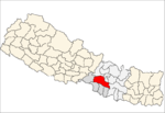 | |
| Municipalities | ||
| Rural municipalities |
| |