Zones of Qatar
In the administrative divisions of Qatar, zones are the second-highest level of government after municipalities. As of the 2015 census, there were 98 zones.[1] However, several of these zones are not currently in use.[2] Over the years, numerous changes in zones have taken place. For instance, in the 2010 census, Zone 69 was transferred to Al Daayen Municipality, Zones 50 and 58 were added to Ad-Dawhah Municipality, and part of Zone 74 was merged with Zone 70 of Al Daayen Municipality.[3]
| Zones | |
|---|---|
| Category | Unitary state |
| Location | State of Qatar |
| Number | 98 Zones |
| Populations | 7 (Zone 98) – 364,710 (Zone 57) |
| Areas | 0.077 sq mi (0.2 km2) (Zone 5) – 348.4 sq mi (902.4 km2) (Zone 95) |
| Subdivisions | Districts Blocks |
Zones 1 – 50, 57, 58, and 60 – 68 are reserved for Ad-Dawhah Municipality; Zones 51 – 56, 81, 83, 96 and 97 are reserved for Al Rayyan Municipality; Zones 69 and 70 are reserved for Al Daayen Municipality; Zone 71 is reserved for Umm Salal Municipality; Zones 74 – 76 are reserved for Al Khor Municipality; Zones 77 – 79 are reserved for Al Shamal Municipality; Zones 90 – 95 and 98 are reserved for Al Wakrah Municipality; and Zones 72, 73, 80, 82, and 84 – 86 are reserved for Al-Shahaniya Municipality.[1]
Zones are composed of planning districts, of which there are 773 as of 2015.[4] The lowest statistical unit used for planning is a census block, of which the total in 2010 was 4,344, increasing from 2,464 in 2004.[5]
Zones by municipality
Ad Dawhah Municipality
There are 52 zones designated in Ad Dawhah Municipality as of 2015.[1]
| Zone not recorded in latest census (2015) | |
| Zone no. | Districts | Area (km²) | Population (2015) |
|---|---|---|---|
| 1 | Al Jasrah | 0.4 | 240 (2010)[6] |
| 2 | Al Bidda | N/A | 35 (2010)[6] |
| 3 | Fereej Mohamed Bin Jasim Mushayrib | N/A | 4,886 (2010)[6] |
| 4 | Mushayrib | 0.3 | 9,791 |
| 5 | Al Najada Barahat Al Jufairi Fereej Al Asmakh | 0.2 | 2,086 |
| 6 | Old Al Ghanim | 0.3 | 1,124 |
| 7 | Al Souq | 0.3 | 297 |
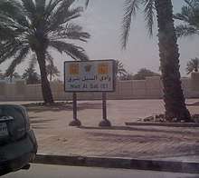
| 10 | Wadi Al Sail | N/A | 8 (2010)[6] |
| 11 | Rumeilah | N/A | 63 (2010)[6] |
| 12 | Al Bidda | N/A | 1,067 (2010)[6] |
| 13 | Mushayrib | 0.7 | 18,278 |
| 14 | Fereej Abdel Aziz | 0.5 | 15,706 |
| 15 | Ad Dawhah al Jadidah | 0.5 | 15,920 |
| 16 | Old Al Ghanim | 0.4 | 16,334 |
| 17 | Al Rufaa Old Al Hitmi | 0.4 | 6,026 |
| 18 | As Salatah Al Mirqab | 0.6 | 692 |
| 19 | Doha Port | N/A | 6 (2010)[6] |
| 20 | Wadi Al Sail | 1.3 | 240 |
| 21 | Rumeilah | 0.8 | 1,590 |
| 22 | Fereej Bin Mahmoud | 0.6 | 11,241 |
| 23 | Fereej Bin Mahmoud | 1.8 | 17,086 |
| 24 | Rawdat Al Khail | 1.7 | 18,200 |
| 25 | Fereej Bin Durham Al Mansoura | 1.5 | 37,082 |
| 26 | Najma | 1.1 | 28,228 |
| 27 | Umm Ghuwailina | 1.4 | 33,262 |
| 28 | Al Khulaifat Ras Abu Aboud | 0.9 | 1,731 |
| 30 | Duhail | 6.8 | 7,705 |
| 31 | Umm Lekhba | 3.1 | 11,897 |
| 32 | Madinat Khalifa North Dahl Al Hamam | 2.4 | 12,364 |
| 33 | Al Markhiya | 2.7 | 6,242 |
| 34 | Madinat Khalifa South | 2.6 | 38,247 |
| 35 | Fereej Kulaib | 1.1 | 6,507 |
| 36 | Al Messila | 2.1 | 6,803 |
| 37 | Fereej Bin Omran New Al Hitmi Hamad Medical City | 2.5 | 26,121 |
| 38 | Al Sadd | 3.5 | 17,820 |
| 39 | Al Sadd New Al Mirqab Fereej Al Nasr | 2.7 | 23,853 |
| 40 | New Salatah | 3.5 | 16,086 |
| 41 | Nuaija | 1.2 | 4,743 |
| 42 | Al Hilal | 1.8 | 11,671 |
| 43 | Nuaija | 4.8 | 14,871 |
| 44 | Nuaija | 3.2 | 13,765 |
| 45 | Old Airport | 4.7 | 48,525 |
| 46 | Al Thumama | 3.7 | 8,552 |
| 47 | Al Thumama | 3.3 | 12,815 |
| 48 | Doha International Airport | 11.6 | 1,853 |
| 49 | Doha International Airport | 36.9 | 442 |
| 50 | Zone 50 | 7.6 | 1,137 |
| 57 | Industrial Area | 32.1 | 364,710 |
| 58 | Zone 58 | 0.8 | 4,692 |
| 61 | Al Dafna Al Qassar | 4.0 | 4,022 |
| 63 | Onaiza | 2.0 | 7,562 |
| 64 | Lejbailat | 1.4 | 4,151 |
| 65 | Onaiza | 2.1 | 7,875 |
| 66 | Onaiza Leqtaifiya Al Qassar | 26.1 | 22,024 |
| 67 | Hazm Al Markhiya | 4.2 | 8,967 |
| 68 | Jelaiah Al Tarfa Jeryan Nejaima | 9.7 | 5,521 |
| Municipality | 234 | 956,457 | |
Al Rayyan Municipality
There are 10 zones designated in Al Rayyan Municipality as of 2015.[1]
| Zone no. | Districts | Area (km²) | Population (2015) |
|---|---|---|---|
| 51 | Al Gharrafa Gharrafat Al Rayyan Izghawa Bani Hajer Al Seej Rawdat Egdaim Al Themaid | 80.9 | 56,027 |
| 52 | Al Luqta Lebday Old Al Rayyan Al Shagub Fereej Al Zaeem | 13.4 | 18,433 |
| 53 | New Al Rayyan Al Wajbah Muaither | 110.9 | 77,875 |
| 54 | Fereej Al Amir Luaib Muraikh Baaya Mehairja Fereej Al Soudan | 18.1 | 24,593 |
| 55 | Fereej Al Soudan Al Waab Al Aziziya New Fereej Al Ghanim Fereej Al Murra Fereej Al Manaseer Bu Sidra Muaither Al Sailiya Al Mearad | 82.4 | 283,675 |
| 56 | Fereej Al Asiri New Fereej Al Khulaifat Bu Samra Al Mamoura Abu Hamour Mesaimeer Ain Khaled | 61.1 | 128,928 |
| 81 | Mebaireek | 160.5 | 12,483 |
| 83 | Al Karaana | 554.3 | 2,614 |
| 96 | Abu Samra | 801.7 | 984 |
| 97 | Sawda Natheel | 566.7 | 100 |
| Total | 2450 | 605,712 | |
Al Daayen Municipality
There are 2 zones designated in Al Daayen Municipality as of 2015.[1]
| Zone no. | Districts | Area (km²) | Population (2015) |
|---|---|---|---|
| 69 | Jabal Thuaileb Al Kharayej Lusail Al Egla Wadi Al Banat | 51.1 | 1,338 |
| 70 | Leabaib Al Ebb Jeryan Jenaihat Al Kheesa Rawdat Al Hamama Wadi Al Wasaah Al Sakhama Al Masrouhiya Wadi Lusail Lusail Umm Qarn Al Daayen | 239.1 | 53,001 |
| Total | 290.2 | 54,339 | |
Umm Salal Municipality
There is 1 zone designated in Umm Salal Municipality as of 2015.[1]
| Zone no. | Districts | Area (km²) | Population (2015) |
|---|---|---|---|
| 71 | Bu Fasseela Izghawa Al Kharaitiyat Umm Salal Ali Umm Salal Mohammed Saina Al-Humaidi Umm Al Amad Umm Ebairiya | 318.4 | 90,835 |
| Total | 318.4 | 90,835 | |
Al Khor Municipality
There are 3 zones designated in Al Khor Municipality as of 2015.[1]
| Zone no. | Districts | Area (km²) | Population (2015) |
|---|---|---|---|
| 74 | Simaisma Al Jeryan Al Khor City | 373.9 | 96,169 |
| 75 | Al Thakhira Ras Laffan Umm Birka | 610.8 | 100,118 |
| 76 | Al Ghuwariyah | 628.6 | 5,744 |
| Total | 1613.3 | 202,031 | |
Al Shamal Municipality
There are 3 zones designated in Al Shamal Municipality as of 2015.[1]
| Zone no. | Districts | Area (km²) | Population (2015) |
|---|---|---|---|
| 77 | Ain Sinan Madinat Al Kaaban Fuwayrit | 266.0 | 1,727 |
| 78 | Abu Dhalouf Zubarah | 427.2 | 1,660 |
| 79 | Madinat ash Shamal Ar Ru'ays | 166.6 | 5,407 |
| Total | 859.8 | 8,794 | |
Al Shahaniya Municipality
There are 10 zones designated in Al-Shahaniya Municipality as of 2015.[1]
| Zone no. | Districts | Area (km²) | Population (2015) |
|---|---|---|---|
| 72 | Al Utouriya | 662.2 | 1,232 |
| 73 | Al Jemailiya | 623.3 | 1,685 |
| 80 | Al-Shahaniya City | 287.1 | 138,509 |
| 82 | Rawdat Rashed | 454.1 | 26,258 |
| 84 | Umm Bab | 494.1 | 5,305 |
| 85 | Al Nasraniya | 423.2 | 1,308 |
| 86 | Dukhan | 365 | 13,274 |
| Total | 3309 | 187,571 | |
Al Wakrah Municipality
There are 7 zones designated in Al Wakrah Municipality as of 2015.[1]
| Zone no. | Districts | Area (km) | Population (2015) |
|---|---|---|---|
| 90 | Al Wakrah | 75.8 | 87,970 |
| 91 | Al Thumama Al Wukair Al Mashaf | 203.4 | 165,214 |
| 92 | Mesaieed | 133.2 | 37,548 |
| 93 | Mesaieed Industrial Area | 60.7 | 106 |
| 94 | Shagra | 497.2 | 4,714 |
| 95 | Al Kharrara | 902.4 | 3,478 |
| 98 | Khawr al Udayd | 705 | 7 |
| Total | 2577.7 | 299,037 | |
References
- "2015 Population census" (PDF). Ministry of Development Planning and Statistics. April 2015. Retrieved 11 February 2019.
- "Qatar Development Atlas - Part 1" (PDF). Ministry of Development Planning and Statistics. 2010. p. 7. Retrieved 11 February 2019.
- "Qatar Development Atlas - Part 1" (PDF). Ministry of Development Planning and Statistics. 2010. p. 8. Retrieved 11 February 2019.
- "District Area Map". Ministry of Development Planning and Statistics. Retrieved 11 February 2019.
- "Qatar Development Atlas - Part 1" (PDF). Ministry of Development Planning and Statistics. 2010. p. 16. Retrieved 11 February 2019.
- "2010 Population census" (PDF). Ministry of Development Planning and Statistics. 2010. Retrieved 11 February 2019.
Qatar articles | |||||
|---|---|---|---|---|---|
| Geography |
|  | |||
| Politics | |||||
| Economy | |||||
| Society |
| ||||
| |||||