West Coast Council
| West Coast Council Tasmania | |||||||||||||||
|---|---|---|---|---|---|---|---|---|---|---|---|---|---|---|---|
|
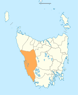
Map showing the West Coast local government area. | |||||||||||||||
| Coordinates | 42°17′54″S 145°37′44″E / 42.2984°S 145.6289°ECoordinates: 42°17′54″S 145°37′44″E / 42.2984°S 145.6289°E | ||||||||||||||
| Population | 4,149 (2016)[1] | ||||||||||||||
| • Density | 0.4/km2 (1.0/sq mi) | ||||||||||||||
| Established | 2 April 1993[2] | ||||||||||||||
| Area | 9,574.5 km2 (3,696.7 sq mi) | ||||||||||||||
| Mayor | Phil Vickers | ||||||||||||||
| Council seat | Zeehan | ||||||||||||||
| Region | West Coast | ||||||||||||||
| State electorate(s) | Braddon | ||||||||||||||
| Federal Division(s) | Braddon | ||||||||||||||
|
| |||||||||||||||
| Website | West Coast Council | ||||||||||||||
| |||||||||||||||
West Coast Council is a local government body in Tasmania, covering much of the western region of the state. West Coast is classified as a rural local government area and has a population of 4,149, the major towns and localities of the region include Strahan, Rosebery, Queenstown and the principal town of Zeehan.
History and attributes
The West Coast has a rich mining and railway heritage as well as a historic convict settlement. It is the largest of the 29 Tasmanian councils by area, and the second least densely populated, after the Central Highlands. It takes in the West Coast Range as well as portions of the World Heritage areas.
The region experiences relatively extreme weather conditions, notably high yearly rainfall totals due to frontal systems, especially at Lake Margaret and Mount Read.
West Coast is classified as rural, agricultural and medium (RAM) under the Australian Classification of Local Governments.[3]
History
On 2 April 1993, the municipalities of Lyell, Strahan and Zeehan were amalgamated to form the West Coast Council.[2][4]
Historically the region was more oriented towards the North - due to the main transport being by either rail to Burnie up until the 1950s and 1960s, or by ship out of Strahan until the mid twentieth century. There are no land based transport routes to the south. Consequently, many residents who could afford shopping trips would go to Melbourne in Victoria, rather than Hobart in Tasmania.
Some of the small population is located in the small cluster of towns near Macquarie Harbour - Strahan and Queenstown, these were linked in their connection with the Mount Lyell Mining and Railway Company
While further north Zeehan and Rosebery are settlements that developed from early quite separate mining operations, but were linked by their reliance upon the Emu Bay Railway There a number of ghost towns or abandoned mining communities in the West Coast, with some such as Crotty actually submerged under hydro-electric scheme dams.
Government
Mayors
Localities
| Zeehan | 728 | |
| Rosebery | 922 | |
| Strahan | 824 | Includes Trial Harbour, Regatta Point |
| Queenstown | 1,975 | Includes South Queenstown |
| South Queenstown | Incl. in Queenstown | |
| Williamsford | Incl. in Granville Harbour | |
| Renison Bell | Incl. in Granville Harbour | |
| Stinger Creek | Incl. in Granville Harbour | |
| Tullah | 192 | |
| Trial Harbour | Incl. in Strahan | |
| Regatta Point | Incl. in Strahan | |
| Total | 4,678 | |
| 0 | Variance | |
| Local government total | 4,678 | Gazetted West Coast Local Government Area |
See also
References
- ↑ Australian Bureau of Statistics (27 June 2017). "West Coast". 2016 Census QuickStats. Retrieved 9 June 2016.

- 1 2 "Agency Details: West Coast Municipal Council". search.archives.tas.gov.au. Tasmanian Government. Retrieved 11 June 2018.
- ↑ "Local government national report 2014-2015". regional.gov.au. Australian Government. Retrieved 8 June 2018.
- ↑ "Gormanston Municipality". Daily Post. IV, (243). Tasmania, Australia. 14 October 1911. p. 4. Retrieved 18 April 2017 – via National Library of Australia.
- ↑ "Farewell Mayor Gerrity". West Coast Council. October 2013. Retrieved 20 October 2013. Public Information Article.
- ↑ "West Coast". Department of Premier and Cabinet - Tasmania. October 2013. Retrieved 20 October 2013. Municipal Directory.
External links
- West Coast Council official website
- Local Government Association Tasmania
- Tasmanian Electoral Commission - local government