Central Highlands Council
| Central Highlands Council Tasmania | |||||||||||||||
|---|---|---|---|---|---|---|---|---|---|---|---|---|---|---|---|
|
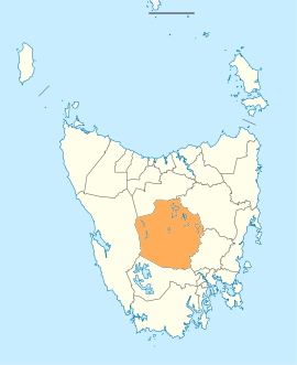
Map showing the Central Highlands local government area. | |||||||||||||||
| Coordinates | 42°12′45″S 146°38′46″E / 42.2124°S 146.646°ECoordinates: 42°12′45″S 146°38′46″E / 42.2124°S 146.646°E | ||||||||||||||
| Population | 2,141 (2016)[1] | ||||||||||||||
| • Density | 0.3/km2 (0.78/sq mi) | ||||||||||||||
| Established | 2 April 1993[2] | ||||||||||||||
| Area | 7,976.4 km2 (3,079.7 sq mi) | ||||||||||||||
| Mayor | Loueen Triffitt | ||||||||||||||
| Council seat | Hamilton | ||||||||||||||
| Region | Central Highlands | ||||||||||||||
| State electorate(s) | Lyons | ||||||||||||||
| Federal Division(s) | Lyons | ||||||||||||||
|
| |||||||||||||||
| Website | Central Highlands Council | ||||||||||||||
| |||||||||||||||
Central Highlands Council is a local government body in Tasmania, encompassing the Central Highlands region of the state. Central Highlands is classified as a rural local government area and has a population of 2,141, the two largest towns are Bothwell and Hamilton.
History and attributes
Central Highlands was established on 2 April 1993 after the amalgamation of the Bothwell and Hamilton municipalities.[2]
Central Highlands is the least densely populated local government area of Tasmania, with only 0.3 people per square kilometre. The municipality is classified as rural, agricultural and medium (RAM) under the Australian Classification of Local Governments.[3]
Towns
The population of the area is small and quite decentralised, resulting in a large number of small towns. Some of these towns were founded as support sites for workers on the hydro-electric dams scattered along the upper Derwent River. Main towns are considered Hamilton (council headquarters) and Bothwell.
The towns (with population as of 2006):
- Bothwell (376)
- Bronte Park (16)
- Derwent Bridge (?)
- Hamilton (300)
- Liawenee (?)
- Miena (104)
- Ouse (137)
- Tarraleah
Townships
The municipality is subdivided into eight townships:[4]
- Hamilton Township
- Ouse Township
- Gretna Township
- Ellendale Township
- Fentonbury Township
- Westerway Township
- Wayatinah Township
- Bothwell Township
Parks and reserves
It covers most of the mountainous centre of the state, also known as the Central Plateau which contains the Central Plateau Conservation Area including sections of the Tasmanian Wilderness World Heritage Area, as well as the Cradle Mountain-Lake St Clair National Park, and Walls of Jerusalem National Park. Other smaller reserves of different status occur in the region as well.
Government
| Name | Position[5] | Party affiliation | |
|---|---|---|---|
| Loueen Triffitt | Mayor/Councillor | Independent | |
| Lana Benson | Deputy Mayor/Councillor | Independent | |
| Jim Allwright | Councillor | Independent | |
| Tony Bailey | Councillor | Independent | |
| Richard Bowden OAM | Councillor | Independent | |
| Robert Cassidy | Councillor | Independent | |
| Julie Honner | Councillor | Independent | |
| Erika McRae | Councillor | Independent | |
| Jim Poore | Councillor | Independent | |
See also
References
- ↑ Australian Bureau of Statistics (27 June 2017). "Central Highlands". 2016 Census QuickStats. Retrieved 8 June 2016.

- 1 2 "Agency Details: Central Highlands". search.archives.tas.gov.au. Tasmanian Government. Retrieved 11 June 2018.
- ↑ "Local government national report 2014-2015". regional.gov.au. Australian Government. Retrieved 8 June 2018.
- ↑ "Archived copy" (PDF). Archived from the original (PDF) on 2009-05-23. Retrieved 2009-06-09.
- ↑ "Councillor Details - Central Highlands Council". centralhighlands.tas.gov.au. Central Highlands Council. Retrieved 1 February 2015.
Further reading
- Jetson, Tim.(1989) The roof of Tasmania: a history of the Central Plateau Launceston, Tas.: Pelion Press. ISBN 0-7316-7214-3
External links
- Central Highlands Council official website
- Local Government Association Tasmania
- Tasmanian Electoral Commission - local government