West Tamar Council
| West Tamar Council Tasmania | |||||||||||||||
|---|---|---|---|---|---|---|---|---|---|---|---|---|---|---|---|
|
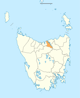
Map showing the West Tamar local government area. | |||||||||||||||
| Coordinates | 41°16′47″S 146°51′55″E / 41.2797°S 146.8652°ECoordinates: 41°16′47″S 146°51′55″E / 41.2797°S 146.8652°E | ||||||||||||||
| Population | 22,718 (2016 census)[1] | ||||||||||||||
| • Density | 34.3/km2 (89/sq mi) | ||||||||||||||
| Established | 2 April 1993[2] | ||||||||||||||
| Area | 689 km2 (266.0 sq mi) | ||||||||||||||
| Mayor | Christina Holmdahl | ||||||||||||||
| Council seat | Beaconsfield | ||||||||||||||
| Region | Western Tamar Valley | ||||||||||||||
| State electorate(s) | Bass | ||||||||||||||
| Federal Division(s) | Bass | ||||||||||||||
|
| |||||||||||||||
| Website | West Tamar Council | ||||||||||||||
| |||||||||||||||
West Tamar Council is a local government body in Tasmania, situated along the western side of the Tamar River in the north of the state. West Tamar is classified as an urban local government area and has a population of 22,718, it extends from the outer reaches of north-west Launceston and includes the towns and localities of Beaconsfield, Beauty Point and Legana.
History and attributes
The municipality was established on 2 April 1993, after the boundaries of the Beaconsfield municipality were extended and its name changed to West Tamar.[2] West Tamar is classified as urban, fringe and small (UFS) under the Australian Classification of Local Governments.[3]
The municipal area starts with the Launceston suburb of Riverside in the south; the satellite suburb of Legana; the towns of Exeter, Beaconsfield and Beauty Point, all the way up to the beach resort town of Greens Beach at the mouth of the Tamar River.
Suburbs[4]
| Suburb | Census population 2016 | Reason |
|---|---|---|
| Badger Head | 41 | |
| York Town | 72 | |
| Greens Beach | 209 | |
| Kelso | 146 | |
| Clarence Point | 226 | |
| Ilfraville | Incl. in Beauty Point | |
| Beauty Point | 1222 | Includes Ilfraville |
| Beaconsfield | 1298 | |
| Rowella | 170 | |
| Kayena | 219 | Includes Richmond Hill |
| Richmond Hill | Incl. in Kayena | |
| Sidmouth | 394 | |
| Deviot | 337 | |
| Robygana | 111 | |
| Swan Point | 282 | |
| Loira | 160 | |
| Gravelly Beach | 567 | |
| Exeter | 633 | |
| Blackwall | 270 | |
| Lanena | 320 | |
| Rosevears | 352 | |
| Grindelwald | 965 | |
| Legana | 4029 | Includes Danbury Park |
| Danbury Park | Incl. in Legana | |
| Riverside | 6424 | |
| Bridgenorth | 373 | |
| Notley Hills | 46 | |
| Glengarry | 525 | |
| Frankford | 176 | |
| Winkleigh | 203 | |
| Holwell | 65 | |
| Flowery Gully | 87 | |
| Total | 19,992 | |
| 2726 | Variance | |
| Local government total | 22,718 | Gazetted West Tamar Local Government Area |
See also
References
- ↑ Australian Bureau of Statistics (27 June 2017). "West Tamar (M)". 2016 Census QuickStats. Retrieved 23 November 2017.

- 1 2 "Agency Details: West Tamar Council". search.archives.tas.gov.au. Tasmanian Government. Retrieved 11 June 2018.
- ↑ "Local government national report 2014-2015". regional.gov.au. Australian Government. Retrieved 8 June 2018.
- ↑ Australian Bureau of Statistics. "2016 Census QuickStats". Retrieved 23 July 2017.
External links
- West Tamar Council official website
- Local Government Association Tasmania
- Tasmanian Electoral Commission - local government