Meander Valley Council, Tasmania
| Meander Valley Council Tasmania | |||||||||||||||
|---|---|---|---|---|---|---|---|---|---|---|---|---|---|---|---|
|
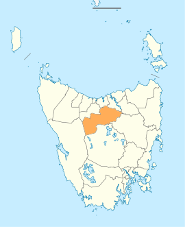
Map showing the Meander Valley local government area. | |||||||||||||||
| Coordinates | 41°37′36″S 146°29′06″E / 41.6267°S 146.4849°ECoordinates: 41°37′36″S 146°29′06″E / 41.6267°S 146.4849°E | ||||||||||||||
| Population | 19,282 (2016)[1] | ||||||||||||||
| • Density | 5.8/km2 (15/sq mi) | ||||||||||||||
| Established | 2 April 1993[2] | ||||||||||||||
| Area | 3,821 km2 (1,475.3 sq mi) | ||||||||||||||
| Mayor | Craig Perkins[3] | ||||||||||||||
| Council seat | Westbury | ||||||||||||||
| Region | Great Western Tiers | ||||||||||||||
| State electorate(s) | Lyons, Bass | ||||||||||||||
| Federal Division(s) | Lyons, Bass | ||||||||||||||
|
| |||||||||||||||
| Website | Meander Valley Council | ||||||||||||||
| |||||||||||||||
Meander Valley Council is a local government body in Tasmania, it covers the outer western reaches of Launceston, and further westward along the Meander River. The Meander Valley LGA is classified as a rural local government area and has a population of 19,282, major towns and localities of the region include Elizabeth Town, Mole Creek, Westbury and the principal town of Deloraine.
History and attributes
On 2 April 1993, the municipalities of Deloraine and Westbury were amalgamated to form the Meander Valley Council.[2][4] Meander Valley is classified as rural, agricultural and very large (RAV) under the Australian Classification of Local Governments.[5]
Localities
The municipality includes the localities of Bracknell, Carrick, Chudleigh, Hagley, Meander, Mole Creek, Westbury, Elizabeth Town, Caveside, Exton and Travellers Rest. It also includes the outer western suburbs of Launceston including Blackstone Heights and Prospect Vale, and the satellite town of Hadspen.
A majority of the Great Western Tiers mountain range is within the Meander Valley municipal area.
Localities and suburbs
List of localities and suburbs.[6][7]
| Localities | Census population 2011 | Reason |
|---|---|---|
| Kimberley | 436 | Includes Weegena, Moltema, Dunorlan |
| Weegena | Incl. in Kimberley | |
| Moltema | Incl. in Kimberley | |
| Dunorlan | Incl. in Kimberley | |
| Elizabeth Town | 420 | Includes Parkham |
| Parkham | Incl. in Elizabeth Town | |
| Reedy Marsh | 309 | |
| Birralee | 362 | Includes Rosevale, Selbourne |
| Rosevale | Incl. in Birralee | |
| Selbourne | Incl. in Birralee | |
| Westwood | Incl. in Carrick | |
| Blackstone Heights | 1,294 | |
| Travellers Rest | 244 | |
| Prospect Vale | 5,021 | |
| Hadspen | 2,063 | |
| Quamby Bend | Incl. in Westbury | |
| Quamby Brook | Incl. in Golden Valley | |
| Westbury | 2,104 | Includes Quamby Bend, Osmaston |
| Osmaston | Incl. in Westbury | |
| Carrick | 870 | Includes Westwood, Oaks |
| Hagley | 330 | |
| Whitemore | 236 | Includes Cluan |
| Oaks | Incl. in Carrick | |
| Cluan | Incl. in Whitemore | |
| Montana | Incl. in Meander | |
| Bracknell | 375 | |
| Liffey | 259 | |
| Golden Valley | 290 | Includes Quamby Brook |
| Jackeys Marsh | Incl. in Meander | |
| Meander | 415 | Includes Jackeys Marsh |
| Western Creek | Incl. in Caveside | |
| Lake McKenzie | Incl. in Mersey Forest | |
| Rowallan | Incl. in Mersey Forest | |
| Mersey Forest | 0 | Includes Lake McKenzie, Rowallan, Parangana, Lemonthyme, Cradle Mountain |
| Parangana | Incl. in Mersey Forest | |
| Lemonthyme | Incl. in Mersey Forest | |
| Cradle Mountain | Incl. in Mersey Forest, Staverton (Kentish) | |
| Liena | Incl. in Mole Creek | |
| Mayberry | Incl. in Mole Creek | |
| Mole Creek | 609 | Includes Mayberry, Liena |
| Caveside | 318 | Includes Western Creek, Dairy Plains |
| Chudleigh | Includes Needles, Red Hills, Lemana Junction | |
| Needles | Incl. in Chudleigh | |
| Red Hills | Incl. in Chudleigh | |
| Lemana Junction | Incl. in Chudleigh | |
| Deloraine | 2,741 | |
| Exton | Incl. in Reedy Marsh | |
| Total | 19,031 | |
| (143) | Variance | |
| Local government total | 18,888 | Gazetted Central Coast Local Government Area |
See also
References
- ↑ Australian Bureau of Statistics (27 June 2017). "Meander Valey". 2016 Census QuickStats. Retrieved 9 June 2016.

- 1 2 "Agency Details: Meander Valley Council". search.archives.tas.gov.au. Tasmanian Government. Retrieved 11 June 2018.
- ↑ "Your Council". Meander Valley Council. Retrieved 30 May 2012.
- ↑ "Council Profile". Meander Valley Council. Retrieved 30 May 2012.
- ↑ "Local government national report 2014-2015". regional.gov.au. Australian Government. Retrieved 8 June 2018.
- ↑ Not all localities are suburbs
- ↑ Australian Bureau of Statistics. "2011 Census QuickStats". Retrieved 5 April 2016.
External links
- Meander Valley Council - official website
- Local Government Association Tasmania
- Tasmanian Electoral Commission - local government