Latrobe Council
| Latrobe Council Tasmania | |||||||||||||||
|---|---|---|---|---|---|---|---|---|---|---|---|---|---|---|---|
|
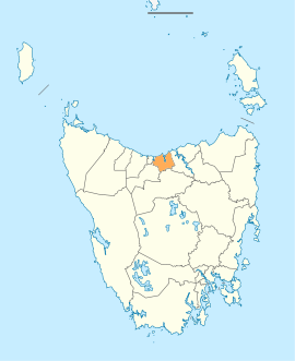
Map showing the Latrobe local government area. | |||||||||||||||
| Coordinates | 41°14′29″S 146°33′35″E / 41.2413°S 146.5598°ECoordinates: 41°14′29″S 146°33′35″E / 41.2413°S 146.5598°E | ||||||||||||||
| Population | 10,699 (2016 census)[1] | ||||||||||||||
| • Density | 19.5/km2 (51/sq mi) | ||||||||||||||
| Established | 1 January 1907[2] | ||||||||||||||
| Area | 550 km2 (212.4 sq mi) | ||||||||||||||
| Mayor | Peter Freshney | ||||||||||||||
| Council seat | Latrobe | ||||||||||||||
| Region | North West Tasmania | ||||||||||||||
| State electorate(s) | Braddon | ||||||||||||||
| Federal Division(s) | Braddon | ||||||||||||||
|
| |||||||||||||||
| Website | Latrobe Council | ||||||||||||||
| |||||||||||||||
Latrobe Council is a local government body in Tasmania, situated in the north of the state, east of Devonport. The Latrobe local government area is classified as rural and has a population of 10,699, it encompasses the principal town, Latrobe, and the nearby localities including Port Sorell, Sassafras and Wesley Vale.
History and attributes
The Latrobe municipality was established on 1 January 1907.[2] Latrobe is classified as rural, agricultural and very large (RAV) under the Australian Classification of Local Governments.[3]
Suburbs[4]
| Suburb | Census population 2016 | Reason |
|---|---|---|
| Wesley Vale | 443 | |
| Northdown | 221 | |
| Hawley Beach | 483 | |
| Shearwater | 1,764 | |
| Port Sorell | 2,022 | |
| Squeaking Point | 223 | |
| Thirlstane | 94 | |
| Bakers Beach | 60 | |
| Merseylea | 56 | |
| Sassafras | 347 | |
| Harford | 74 | |
| Moriarty | 223 | |
| Latrobe | 4,169 | |
| Tarleton. | 380 | |
| Total | 10,559 | |
| 140 | Variance | |
| Local government total | 10,699 | Gazetted Central Coast Local Government Area |
See also
References
- ↑ Australian Bureau of Statistics (27 June 2017). "Latrobe (Tas) (M)". 2016 Census QuickStats. Retrieved 20 March 2018.

- 1 2 "Agency Details: Latrobe Municipal Council". search.archives.tas.gov.au. Tasmanian Government. Retrieved 11 June 2018.
- ↑ "Local government national report 2014-2015". regional.gov.au. Australian Government. Retrieved 8 June 2018.
- ↑ Australian Bureau of Statistics. "2016 Census QuickStats". Retrieved 22 July 2017.
External links
- Latrobe Council official website
- Local Government Association Tasmania
- Tasmanian Electoral Commission - local government
This article is issued from
Wikipedia.
The text is licensed under Creative Commons - Attribution - Sharealike.
Additional terms may apply for the media files.