Southern Midlands Council
| Southern Midlands Council Tasmania | |||||||||||||||
|---|---|---|---|---|---|---|---|---|---|---|---|---|---|---|---|
|
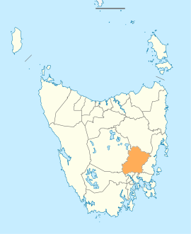
Map showing the Southern Midlands local government area. | |||||||||||||||
| Coordinates | 42°26′05″S 147°24′02″E / 42.4346°S 147.4006°ECoordinates: 42°26′05″S 147°24′02″E / 42.4346°S 147.4006°E | ||||||||||||||
| Population | 6,043 (2016)[1] | ||||||||||||||
| • Density | 2.3/km2 (6.0/sq mi) | ||||||||||||||
| Established | 2 April 1993[2] | ||||||||||||||
| Area | 2,561 km2 (988.8 sq mi) | ||||||||||||||
| Mayor | Anthony Bisdee | ||||||||||||||
| Council seat | Oatlands | ||||||||||||||
| Region | Southern Midlands region | ||||||||||||||
| State electorate(s) | Lyons | ||||||||||||||
| Federal Division(s) | Lyons | ||||||||||||||
|
| |||||||||||||||
| Website | Southern Midlands Council | ||||||||||||||
| |||||||||||||||
Southern Midlands is a local government body in Tasmania, covering the southern region of the Tasmanian central midlands. Southern Midlands is classified as a rural local government area and has a population of 6,043, the major localities of the region include Campania, Kempton, Mangalore and the principal town of Oatlands.
History and attributes
On 2 April 1993, Oatlands and Green Ponds were amalgamated with parts of the municipalities of Brighton and Richmond to form the new Southern Midlands Council.[2] Southern Midlands is classified as rural, agricultural and large (RAL) under the Australian Classification of Local Governments.[3]
See also
References
- ↑ Australian Bureau of Statistics (27 June 2017). "Southern Midlands". 2016 Census QuickStats. Retrieved 9 June 2016.

- 1 2 "Agency Details: Southern Midlands Municipal Council". search.archives.tas.gov.au. Tasmanian Government. Retrieved 11 June 2018.
- ↑ "Local government national report 2014-2015". regional.gov.au. Australian Government. Retrieved 8 June 2018.
External links
- Southern Midlands Council official website
- Local Government Association Tasmania
- Tasmanian Electoral Commission - local government
This article is issued from
Wikipedia.
The text is licensed under Creative Commons - Attribution - Sharealike.
Additional terms may apply for the media files.