Central Coast Council, Tasmania
| Central Coast Council Tasmania | |||||||||||||||
|---|---|---|---|---|---|---|---|---|---|---|---|---|---|---|---|
|
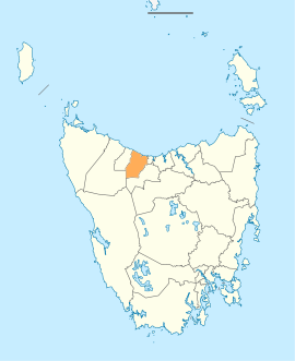
Map showing the Central Coast local government area. | |||||||||||||||
| Coordinates | 41°16′48″S 146°02′28″E / 41.28°S 146.041°ECoordinates: 41°16′48″S 146°02′28″E / 41.28°S 146.041°E | ||||||||||||||
| Population | 21,362 (2016 census)[1] | ||||||||||||||
| • Density | 22.9/km2 (59/sq mi) | ||||||||||||||
| Established | 2 April 1993[2] | ||||||||||||||
| Area | 931.1 km2 (359.5 sq mi) | ||||||||||||||
| Mayor | Jan Bonde | ||||||||||||||
| Council seat | Central Coast, Tasmania | ||||||||||||||
| Region | Ulverstone and Penguin area | ||||||||||||||
| State electorate(s) | Braddon | ||||||||||||||
| Federal Division(s) | Braddon | ||||||||||||||
|
| |||||||||||||||
| |||||||||||||||
Central Coast Council is a local government body in Tasmania, situated in the north-west of the state between Burnie and Devonport. Central Coast is classified as an urban local government area and has a population of 21,362, Ulverstone and Penguin are the two primary towns of the region.
History and attributes
The Central Coast Council was established on 2 April 1993 after the amalgamation of the Penguin and Ulverstone municipalities.[2]
Central Coast is classified as urban, regional and small (URS) under the Australian Classification of Local Governments.[3]
The municipal boundaries are the Blythe River in the west, Braddons Lookout Road in the east and Black Bluff in the south.[4] The Central Coast includes the tourist destinations Leven Canyon[5] and Black Bluff,[6] as well as a number of rural areas such as Upper Castra.
Government
| Name | Position[7] | Party affiliation | |
|---|---|---|---|
| Jan Bonde | Mayor/Councillor | Independent | |
| Kathleen Downie | Deputy Mayor/Councillor | Independent | |
| John Bloomfield | Councillor | Independent | |
| Shane Broad | Councillor | Independent | |
| Garry Carpenter | Councillor | Independent | |
| Gerry Howard | Councillor | Independent | |
| Rowen Tongs | Councillor | Independent | |
| Tony van Rooyen | Councillor | Independent | |
| Phillip Viney | Councillor | Independent | |
Suburbs[8]
| Suburb | Census population 2016 | Reason |
|---|---|---|
| Blthye Heads | Incl. in Heybridge | |
| Heybridge | 430 | Includes Blythe Heads |
| Howth | 54 | |
| Sulphur Creek | 629 | |
| Preservation Bay | 74 | |
| Penguin | 3849 | Includes Carmantown |
| Cuprona | 120 | |
| West Pine | 138 | |
| Carmantown | Incl. in Penguin | |
| West Ulverstone | 4191 | |
| Ulverstone | 6465 | |
| Turners Beach | 1715 | |
| Carmena | 26 | |
| Leith | 415 | |
| Forth | 711 | |
| Kindred | 234 | |
| Upper Castra | 77 | |
| Castra | 51 | |
| Nietta | 64 | |
| South Nietta | 9 | |
| South Preston | 7 | |
| Preston | 150 | Includes Warringa |
| Loongana | 20 | |
| Loyetea | 25 | |
| Heka | Incl. in Gunns Plains | |
| Warringa | Incl. in Preston | |
| Gunns Plains | 171 | Includes Heka |
| Riana | 326 | |
| South Riana | 214 | |
| Sprent | 138 | |
| Spalford | 59 | |
| Abbotsham | 95 | |
| Gawler | 622 | |
| North Motton | 405 | |
| Total | 21,484 | |
| (122) | Variance | |
| Local government total | 21,362 | Gazetted Central Coast Local Government Area |
See also
References
- ↑ Australian Bureau of Statistics (27 June 2017). "Central Coast (M) (Tas.)". 2016 Census QuickStats. Retrieved 23 November 2017.

- 1 2 "Agency Details: Central Coast Council". search.archives.tas.gov.au. Tasmanian Government. Retrieved 11 June 2018.
- ↑ "Local government national report 2014-2015". regional.gov.au. Australian Government. Retrieved 8 June 2018.
- ↑ Central Coast Council - Annual Report 2002-2003
- ↑ Leven Canyon
- ↑ Black Bluff
- ↑ "Councillors - Central Coast Council". centralcoast.tas.gov.au. Central Coast Council. Retrieved 1 February 2015.
- ↑ Australian Bureau of Statistics. "2016 Census QuickStats". Retrieved 22 July 2017.
External links
- Central Coast Council official website
- Local Government Association Tasmania
- Tasmanian Electoral Commission - local government