King Island Council
| King Island Council Tasmania | |||||||||||||||
|---|---|---|---|---|---|---|---|---|---|---|---|---|---|---|---|
|
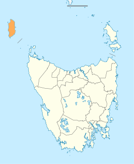
Map showing the King Island local government area. | |||||||||||||||
| Coordinates | 39°51′49″S 143°59′06″E / 39.8637°S 143.9851°ECoordinates: 39°51′49″S 143°59′06″E / 39.8637°S 143.9851°E | ||||||||||||||
| Population | 1,585 (2016)[1] | ||||||||||||||
| • Density | 1.4/km2 (3.6/sq mi) | ||||||||||||||
| Established | 1 January 1907[2] | ||||||||||||||
| Area | 1,100 km2 (424.7 sq mi) | ||||||||||||||
| Mayor | Duncan McFie | ||||||||||||||
| Council seat | Currie | ||||||||||||||
| Region | King Island | ||||||||||||||
| State electorate(s) | Braddon | ||||||||||||||
| Federal Division(s) | Braddon | ||||||||||||||
| Website | King Island Council | ||||||||||||||
| |||||||||||||||
King Island Council is a local government body in Tasmania, encompassing King Island and the adjacent minor islands within Bass Strait, in the north-west of the state. The King Island local government area is classified as rural and has a population of 1,585, with Currie as the main town and administrative centre.
History and attributes
The King Island municipality was established on 1 January 1907[2] King Island is classified as rural, agricultural and small (RAS) under the Australian Classification of Local Governments.[3]
See also
References
- ↑ Australian Bureau of Statistics (27 June 2017). "King Island". 2016 Census QuickStats. Retrieved 9 June 2016.

- 1 2 "Agency Details: King Island Municipal Council". search.archives.tas.gov.au. Tasmanian Government. Retrieved 11 June 2018.
- ↑ "Local government national report 2014-2015". regional.gov.au. Australian Government. Retrieved 8 June 2018.
External links
- King Island Council official website
- Local Government Association Tasmania
- Tasmanian Electoral Commission - local government
This article is issued from
Wikipedia.
The text is licensed under Creative Commons - Attribution - Sharealike.
Additional terms may apply for the media files.