Waratah-Wynyard Council
| Waratah-Wynyard Council Tasmania | |||||||||||||||
|---|---|---|---|---|---|---|---|---|---|---|---|---|---|---|---|
|
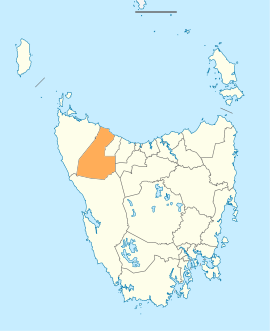
Map showing the Waratah-Wynyard local government area. | |||||||||||||||
| Coordinates | 41°22′58″S 145°29′44″E / 41.3828°S 145.4956°ECoordinates: 41°22′58″S 145°29′44″E / 41.3828°S 145.4956°E | ||||||||||||||
| Population | 13,578 (2016 census)[1] | ||||||||||||||
| • Density | 3.8/km2 (9.8/sq mi) | ||||||||||||||
| Established | 2 April 1993[2] | ||||||||||||||
| Area | 118 km2 (45.6 sq mi) | ||||||||||||||
| Mayor | Robert Walsh | ||||||||||||||
| Council seat | Wynyard | ||||||||||||||
| Region | Wynyard and Waratah | ||||||||||||||
| State electorate(s) | Braddon | ||||||||||||||
| Federal Division(s) | Braddon | ||||||||||||||
|
| |||||||||||||||
| Website | Waratah-Wynyard Council | ||||||||||||||
| |||||||||||||||
Waratah-Wynyard Council is a local government body in Tasmania, situated in the north-west of the state. Waratah-Wynard is classified as a rural local government area and has a population of 13,578, the major towns and localities of the region include Savage River, Sisters Beach, Somerset, Waratah and the principal town of Wynyard.
History and attributes
On 2 April 1993, the municipalities of Waratah and Wynyard were amalgamated to form the Waratah-Wynyard Council.[2] There had been suggestion of renaming the council to Table Cape, which was the former name of the Wynyard Council until 1945, but this move failed at the ballot box.[3]
Waratah-Wynyard is classified as rural, agricultural and very large (RAV) under the Australian Classification of Local Governments.[4]
Logo
The former logo of the council was selected from 124 competition entries in 1987. The enlarged "W" below Table Cape is indicative of ploughed paddocks representing the rural heritage - a lighthouse and a seagull were added to the final design. The word 'Waratah' was added in 1993 following the amalgamation of the councils.
Government
The current mayor is Robert "Robby" Walsh and the current Deputy Mayor is Mary Duniam. Other sitting Councillors are Maureen Bradley, Gary Bramich, Darren Fairbrother, Alwyn Friedersdorff, Kevin Hyland and Stephen Wright. All Councillors will be up for re-election in 2018.[5]
Previous mayors
- Roger Chalk (October 2000 – October 2005)
- Kevin Hyland (October 2005 – December 2010)
Localities[6]
| Locality | Census population 2011 | Reason |
|---|---|---|
| Sisters Creek | 201 | Includes Myalla |
| Sisters Beach | 439 | |
| Boat Harbour Beach | 429 | Includes in Boat Harbour |
| Boat Harbour, Tasmania | Incl. in Boat Harbour Beach | |
| Flowerdale | 324 | Includes Table Cape |
| Table Cape | Incl. in Flowerdale | |
| Wynyard | 5,990 | Includes Seabrook, Doctors Rocks |
| Seabrook | Incl. in Wynyard | |
| Somerset | 3,975 | |
| Doctors Rocks | Incl. in Wynyard | |
| Elliot | 350 | |
| Yolla | 337 | |
| Henrietta | 236 | Includes Oonah, Parrawe, West Takone, Takone |
| Oonah | Incl. in Henrietta | |
| Parrawe | Incl. in Henrietta | |
| Guildford | Incl. in Waratah | |
| Corinna | Incl. in Waratah | |
| Savage River | Incl. in Waratah | |
| West Takone | Incl. in Henrietta | |
| Takone | Incl. in Henrietta | |
| Meunna | Incl. in Lapoinya | |
| Preolenna | Incl. in Lapoinya | |
| Calder | 375 | Includes Kellatier, Moorleah |
| Kellatier | Incl. in Calder | |
| Oldina | 111 | |
| Milabena | Incl. in Lapoinya | |
| Lapoinya | 287 | Includes Meunna, Preolenna, Milabena |
| Moorleah | Incl. Calder | |
| Myalla | Incl. in Sisters Creek | |
| Mount Hicks | 353 | |
| Waratah | 298 | Includes Guildford, Corinna, Savage River |
| Total | 13,705 | |
| 3 | Variance | |
| Local government total | 13,708 | Gazetted Central Coast Local Government Area |
See also
References
- ↑ Australian Bureau of Statistics (27 June 2017). "Waratah/Wynyard (M)". 2016 Census QuickStats. Retrieved 23 November 2017.

- 1 2 "Agency Details: Waratah-Wynyard Municipal Council". search.archives.tas.gov.au. Tasmanian Government. Retrieved 11 June 2018.
- ↑ "The Story Behind Our Logo". warwyn.tas.gov.au. Waratah-Wynyard Council. Retrieved 13 August 2016.
- ↑ "Local government national report 2014-2015". regional.gov.au. Australian Government. Retrieved 8 June 2018.
- ↑ "Waratah-Wynyard Councillors". Waratah-Wynyard Council. Retrieved 9 January 2015.
- ↑ Australian Bureau of Statistics. "2011 Census QuickStats". Retrieved 9 April 2016.
External links
- Waratah-Wynyard Council official website
- Local Government Association Tasmania
- Tasmanian Electoral Commission - local government