Flinders Council
| Flinders Council Tasmania | |||||||||||||||
|---|---|---|---|---|---|---|---|---|---|---|---|---|---|---|---|
|
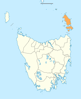
Map showing the Flinders local government area. | |||||||||||||||
| Coordinates | 40°07′10″S 148°05′52″E / 40.1195°S 148.0977°ECoordinates: 40°07′10″S 148°05′52″E / 40.1195°S 148.0977°E | ||||||||||||||
| Population | 906 (2016)[1] | ||||||||||||||
| • Density | 0.5/km2 (1.3/sq mi) | ||||||||||||||
| Established | 1 January 1907[2] | ||||||||||||||
| Area | 2,040.3 km2 (787.8 sq mi) | ||||||||||||||
| Mayor | Carol Cox | ||||||||||||||
| Council seat | Whitemark | ||||||||||||||
| Region | Furneaux Group and surrounding island groups | ||||||||||||||
| State electorate(s) | Bass | ||||||||||||||
| Federal Division(s) | Bass | ||||||||||||||
|
| |||||||||||||||
| Website | Flinders Council | ||||||||||||||
| |||||||||||||||
Flinders Council is a local government body in Tasmania, encompassing the Furneaux Group and nearby islands of Bass Strait, in the north-east of the state. Flinders is classified as a rural local government area and has a population of 906, with Whitemark the main town located on Flinders Island.
History and attributes
The municipality was established on 1 January 1907.[2] Flinders is classified as rural, agricultural and small under the Australian Classification of Local Governments.[3]
Geography
Flinders covers more than 60 islands off the north-eastern tip of Tasmania at the eastern end of Bass Strait. Of these 60, 12 have permanent populations. The bigger ones are Clarke Island, Cape Barren Island, and the largest and most populous, Flinders Island. The Flinders Council includes the Furneaux Group together with the groups of islands to the north west including Kent Group, Hogan Island Group, Curtis Group, Wilsons Promontory Islands (only Tasmanian part).
Rodondo Island is the westernmost landmass of the council area.[4]
See also
References
- ↑ Australian Bureau of Statistics (27 June 2017). "Flinders". 2016 Census QuickStats. Retrieved 8 June 2016.

- 1 2 "Agency Details: Flinders Municipal Council". search.archives.tas.gov.au. Tasmanian Government. Retrieved 11 June 2018.
- ↑ "Local government national report 2014-2015". regional.gov.au. Australian Government. Retrieved 8 June 2018.
- ↑ Council Zoning Part 1 of 2...pdf#page=2 Draft Flinders Council, Planning Scheme 2012 - Zoning
External links
- Flinders Council official website
- Local Government Association Tasmania
- Tasmanian Electoral Commission - local government