Trédarzec
| Trédarzec Tredarzeg | |
|---|---|
| Commune | |
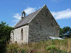 The chapel of Saint-Nicolas of Kerhir, in Trédarzec | |
 Trédarzec Location within Brittany region  Trédarzec | |
| Coordinates: 48°47′15″N 3°11′56″W / 48.7875°N 3.1989°WCoordinates: 48°47′15″N 3°11′56″W / 48.7875°N 3.1989°W | |
| Country | France |
| Region | Brittany |
| Department | Côtes-d'Armor |
| Arrondissement | Lannion |
| Canton | Tréguier |
| Intercommunality | Presqu'île de Lézardrieux |
| Government | |
| • Mayor (2014–2020) | Yvon Le Seguillon |
| Area1 | 11.68 km2 (4.51 sq mi) |
| Population (2008)2 | 1,102 |
| • Density | 94/km2 (240/sq mi) |
| Time zone | UTC+1 (CET) |
| • Summer (DST) | UTC+2 (CEST) |
| INSEE/Postal code | 22347 /22220 |
| Elevation | 0–84 m (0–276 ft) |
|
1 French Land Register data, which excludes lakes, ponds, glaciers > 1 km2 (0.386 sq mi or 247 acres) and river estuaries. 2 Population without double counting: residents of multiple communes (e.g., students and military personnel) only counted once. | |
Trédarzec (Breton: Tredarzeg) is a commune in the Côtes-d'Armor department of Brittany in northwestern France.
Etymology
The name is treb = farmstead, tarz = spring.
Population
| Historical population | ||
|---|---|---|
| Year | Pop. | ±% |
| 1962 | 1,065 | — |
| 1968 | 1,128 | +5.9% |
| 1975 | 997 | −11.6% |
| 1982 | 1,058 | +6.1% |
| 1990 | 1,023 | −3.3% |
| 1999 | 999 | −2.3% |
| 2008 | 1,102 | +10.3% |
Inhabitants of Trédarzec are called trédarzécois in French.
International relations
Trédarzec is twinned with the village of St. Dogmaels in Pembrokeshire, Wales.
See also
References
External links
| Wikimedia Commons has media related to Trédarzec. |
- Trédarzec Website (in French)
- Trédarzec Info Website (in French)
- French Ministry of Culture list for Trédarzec (in French)
This article is issued from
Wikipedia.
The text is licensed under Creative Commons - Attribution - Sharealike.
Additional terms may apply for the media files.