Bulat-Pestivien
| Bulat-Pestivien Bulad-Pestivien | ||
|---|---|---|
| Commune | ||
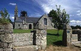 Saint Blaise Chapel | ||
| ||
 Bulat-Pestivien Location within Brittany region  Bulat-Pestivien | ||
| Coordinates: 48°25′46″N 3°19′46″W / 48.4294°N 3.3294°WCoordinates: 48°25′46″N 3°19′46″W / 48.4294°N 3.3294°W | ||
| Country | France | |
| Region | Brittany | |
| Department | Côtes-d'Armor | |
| Arrondissement | Guingamp | |
| Canton | Callac | |
| Intercommunality | Callac-Argoat | |
| Government | ||
| • Mayor (2014–2020) | Yvette Le Maître-Le Bars | |
| Area1 | 31.23 km2 (12.06 sq mi) | |
| Population (2008)2 | 474 | |
| • Density | 15/km2 (39/sq mi) | |
| Time zone | UTC+1 (CET) | |
| • Summer (DST) | UTC+2 (CEST) | |
| INSEE/Postal code | 22023 /22160 | |
| Elevation | 189–307 m (620–1,007 ft) | |
|
1 French Land Register data, which excludes lakes, ponds, glaciers > 1 km2 (0.386 sq mi or 247 acres) and river estuaries. 2 Population without double counting: residents of multiple communes (e.g., students and military personnel) only counted once. | ||
.svg.png)
Bulat-Pestivien (Breton: Bulad-Pestivien) is a commune in the Côtes-d'Armor department of Brittany in northwestern France.
Population
The inhabitants of Bulat-Pestivien are known in French as Bulatois.
| Historical population | ||
|---|---|---|
| Year | Pop. | ±% |
| 1962 | 654 | — |
| 1968 | 812 | +24.2% |
| 1975 | 658 | −19.0% |
| 1982 | 531 | −19.3% |
| 1990 | 446 | −16.0% |
| 1999 | 432 | −3.1% |
| 2008 | 474 | +9.7% |
Breton language
In 2009, 46.0% of primary school children attended bilingual schools.[1]
See also
References
- ↑ (in French) Ofis ar Brezhoneg: Enseignement bilingue Archived 2008-11-14 at the Wayback Machine.
External links
| Wikimedia Commons has media related to Bulat-Pestivien. |
- Official website (in French)
- French Ministry of Culture list for Bulat-Pestivien (in French)
This article is issued from
Wikipedia.
The text is licensed under Creative Commons - Attribution - Sharealike.
Additional terms may apply for the media files.