Le Mené
| Le Mené | |
|---|---|
| Commune | |
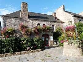 The town hall of Le Mené | |
 Le Mené Location within Brittany region  Le Mené | |
| Coordinates: 48°18′07″N 2°31′08″W / 48.302°N 2.519°WCoordinates: 48°18′07″N 2°31′08″W / 48.302°N 2.519°W | |
| Country | France |
| Region | Brittany |
| Department | Côtes-d'Armor |
| Arrondissement | Saint-Brieuc |
| Canton | Plénée-Jugon |
| Area1 | 163.23 km2 (63.02 sq mi) |
| Population (2013)2 | 6,431 |
| • Density | 39/km2 (100/sq mi) |
| Time zone | UTC+1 (CET) |
| • Summer (DST) | UTC+2 (CEST) |
| INSEE/Postal code | 22046 /22330 |
|
1 French Land Register data, which excludes lakes, ponds, glaciers > 1 km2 (0.386 sq mi or 247 acres) and river estuaries. 2 Population without double counting: residents of multiple communes (e.g., students and military personnel) only counted once. | |
Le Mené is a commune in the Côtes-d'Armor department of western France. The municipality was established on 1 January 2016 and consists of the former communes of Collinée, Le Gouray, Langourla, Plessala, Saint-Gilles-du-Mené, Saint-Gouéno and Saint-Jacut-du-Mené.[1]
See also
References
| Wikimedia Commons has media related to Le Mené. |
- ↑ Arrêté préfectoral 5 October 2015 (in French)
This article is issued from
Wikipedia.
The text is licensed under Creative Commons - Attribution - Sharealike.
Additional terms may apply for the media files.