Plélo
| Plélo Pleuloc'h | ||
|---|---|---|
| Commune | ||
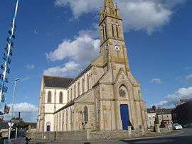 The church of Saint-Pierre and Saint-Paul, in Plélo | ||
| ||
 Plélo Location within Brittany region  Plélo | ||
| Coordinates: 48°33′26″N 2°56′44″W / 48.5572°N 2.9456°WCoordinates: 48°33′26″N 2°56′44″W / 48.5572°N 2.9456°W | ||
| Country | France | |
| Region | Brittany | |
| Department | Côtes-d'Armor | |
| Arrondissement | Guingamp | |
| Canton | Plélo | |
| Intercommunality | Pays de Châtelaudren–Plouagat | |
| Government | ||
| • Mayor (2014–2020) | Patrick Lopin | |
| Area1 | 43.38 km2 (16.75 sq mi) | |
| Population (2008)2 | 3,234 | |
| • Density | 75/km2 (190/sq mi) | |
| Time zone | UTC+1 (CET) | |
| • Summer (DST) | UTC+2 (CEST) | |
| INSEE/Postal code | 22182 /22170 | |
| Elevation | 44–175 m (144–574 ft) | |
|
1 French Land Register data, which excludes lakes, ponds, glaciers > 1 km2 (0.386 sq mi or 247 acres) and river estuaries. 2 Population without double counting: residents of multiple communes (e.g., students and military personnel) only counted once. | ||
.svg.png)
Plélo (Breton: Pleuloc'h, Gallo: Pléloc) is a commune in the Côtes-d'Armor department of Brittany in northwestern France.
Population
| Historical population | ||
|---|---|---|
| Year | Pop. | ±% |
| 1962 | 2,013 | — |
| 1968 | 2,084 | +3.5% |
| 1975 | 2,033 | −2.4% |
| 1982 | 2,177 | +7.1% |
| 1990 | 2,359 | +8.4% |
| 1999 | 2,631 | +11.5% |
| 2008 | 3,234 | +22.9% |
Inhabitants of Plélo are called plélotins in French.
See also
References
External links
| Wikimedia Commons has media related to Plélo. |
- French Ministry of Culture list for Plélo (in French)
This article is issued from
Wikipedia.
The text is licensed under Creative Commons - Attribution - Sharealike.
Additional terms may apply for the media files.