Saint-Clet
| Saint-Clet Sant-Kleve | |
|---|---|
| Commune | |
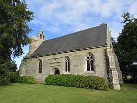 The chapel of Our Lady of Clérin | |
 Saint-Clet Location within Brittany region  Saint-Clet | |
| Coordinates: 48°39′47″N 3°07′52″W / 48.6631°N 3.1311°WCoordinates: 48°39′47″N 3°07′52″W / 48.6631°N 3.1311°W | |
| Country | France |
| Region | Brittany |
| Department | Côtes-d'Armor |
| Arrondissement | Guingamp |
| Canton | Bégard |
| Intercommunality | Trieux |
| Government | |
| • Mayor (2014–2020) | Yannick Bouget |
| Area1 | 14.46 km2 (5.58 sq mi) |
| Population (2008)2 | 845 |
| • Density | 58/km2 (150/sq mi) |
| Time zone | UTC+1 (CET) |
| • Summer (DST) | UTC+2 (CEST) |
| INSEE/Postal code | 22283 /22260 |
| Elevation | 7–99 m (23–325 ft) |
|
1 French Land Register data, which excludes lakes, ponds, glaciers > 1 km2 (0.386 sq mi or 247 acres) and river estuaries. 2 Population without double counting: residents of multiple communes (e.g., students and military personnel) only counted once. | |
Saint-Clet (Breton: Sant-Kleve) is a commune in the Côtes-d'Armor department of Brittany in northwestern France.
Population
| Historical population | ||
|---|---|---|
| Year | Pop. | ±% |
| 1962 | 814 | — |
| 1968 | 885 | +8.7% |
| 1975 | 861 | −2.7% |
| 1982 | 847 | −1.6% |
| 1990 | 744 | −12.2% |
| 1999 | 785 | +5.5% |
| 2008 | 845 | +7.6% |
Inhabitants of Saint-Clet are called saint-clétois in French.
See also
References
External links
| Wikimedia Commons has media related to Saint-Clet (Côtes-d'Armor). |
- French Ministry of Culture list for Saint-Clet (in French)
This article is issued from
Wikipedia.
The text is licensed under Creative Commons - Attribution - Sharealike.
Additional terms may apply for the media files.