Tramain
| Tramain Tremaen | ||
|---|---|---|
| Commune | ||
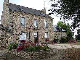 The town hall of Tramain | ||
| ||
 Tramain Location within Brittany region  Tramain | ||
| Coordinates: 48°24′06″N 2°24′03″W / 48.4017°N 2.4008°WCoordinates: 48°24′06″N 2°24′03″W / 48.4017°N 2.4008°W | ||
| Country | France | |
| Region | Brittany | |
| Department | Côtes-d'Armor | |
| Arrondissement | Saint-Brieuc | |
| Canton | Plénée-Jugon | |
| Intercommunality | Arguenon-Hunaudaye | |
| Government | ||
| • Mayor (2014–2020) | Chantal Déjoué | |
| Area1 | 9.25 km2 (3.57 sq mi) | |
| Population (2008)2 | 647 | |
| • Density | 70/km2 (180/sq mi) | |
| Time zone | UTC+1 (CET) | |
| • Summer (DST) | UTC+2 (CEST) | |
| INSEE/Postal code | 22341 /22640 | |
| Elevation | 37–131 m (121–430 ft) | |
|
1 French Land Register data, which excludes lakes, ponds, glaciers > 1 km2 (0.386 sq mi or 247 acres) and river estuaries. 2 Population without double counting: residents of multiple communes (e.g., students and military personnel) only counted once. | ||
.svg.png)
Tramain (Breton: Tremaen, Gallo: Tramaen) is a commune in the Côtes-d'Armor department of Brittany in northwestern France.
Population
| Historical population | ||
|---|---|---|
| Year | Pop. | ±% |
| 1962 | 436 | — |
| 1968 | 463 | +6.2% |
| 1975 | 473 | +2.2% |
| 1982 | 460 | −2.7% |
| 1990 | 483 | +5.0% |
| 1999 | 527 | +9.1% |
| 2008 | 647 | +22.8% |
Inhabitants of Tramain are called traminois in French.
See also
References
External links
| Wikimedia Commons has media related to Tramain. |
- French Ministry of Culture list for Tramain (in French)
This article is issued from
Wikipedia.
The text is licensed under Creative Commons - Attribution - Sharealike.
Additional terms may apply for the media files.