Plancoët
| Plancoët Plangoed | ||
|---|---|---|
| Commune | ||
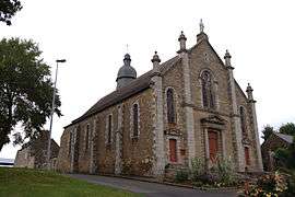 The church of Notre-Dame de Nazareth, in Plancoët | ||
| ||
 Plancoët Location within Brittany region  Plancoët | ||
| Coordinates: 48°31′26″N 2°13′59″W / 48.5239°N 2.2331°WCoordinates: 48°31′26″N 2°13′59″W / 48.5239°N 2.2331°W | ||
| Country | France | |
| Region | Brittany | |
| Department | Côtes-d'Armor | |
| Arrondissement | Dinan | |
| Canton | Plancoët | |
| Intercommunality | Plancoët Val d'Arguenon | |
| Government | ||
| • Mayor (2014–2020) | Patrick Barraux | |
| Area1 | 11.49 km2 (4.44 sq mi) | |
| Population (2008)2 | 3,089 | |
| • Density | 270/km2 (700/sq mi) | |
| Time zone | UTC+1 (CET) | |
| • Summer (DST) | UTC+2 (CEST) | |
| INSEE/Postal code | 22172 /22130 | |
| Elevation | 5–87 m (16–285 ft) | |
|
1 French Land Register data, which excludes lakes, ponds, glaciers > 1 km2 (0.386 sq mi or 247 acres) and river estuaries. 2 Population without double counting: residents of multiple communes (e.g., students and military personnel) only counted once. | ||

Plancoët (Breton: Plangoed, Gallo: Plancoét) is a commune in the Côtes-d'Armor department in Brittany in northwestern France.
Population
| Historical population | ||
|---|---|---|
| Year | Pop. | ±% |
| 1962 | 2,134 | — |
| 1968 | 2,304 | +8.0% |
| 1975 | 2,375 | +3.1% |
| 1982 | 2,489 | +4.8% |
| 1990 | 2,507 | +0.7% |
| 1999 | 2,589 | +3.3% |
| 2008 | 3,089 | +19.3% |
Inhabitants of Plancoët are called plancoëtins in French.
See also
References
External links
| Wikimedia Commons has media related to Plancoët. |
- Official website (in French)
- French Ministry of Culture list for Plancoët (in French)
This article is issued from
Wikipedia.
The text is licensed under Creative Commons - Attribution - Sharealike.
Additional terms may apply for the media files.