Takagi, Nagano
| Takagi 喬木村 | |||
|---|---|---|---|
| Village | |||
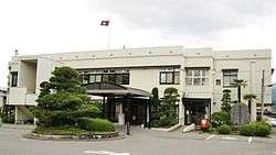 Takagi Village Hall | |||
| |||
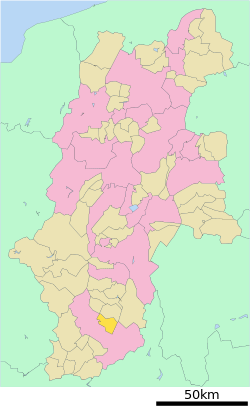 Location of Takagi in Nagano Prefecture | |||
 Takagi | |||
| Coordinates: 35°30′49.7″N 137°52′25.9″E / 35.513806°N 137.873861°ECoordinates: 35°30′49.7″N 137°52′25.9″E / 35.513806°N 137.873861°E | |||
| Country | Japan | ||
| Region | Chūbu (Kōshin'etsu) | ||
| Prefecture | Nagano | ||
| District | Shimoina | ||
| Area | |||
| • Total | 66.61 km2 (25.72 sq mi) | ||
| Population (October 2016) | |||
| • Total | 6,298 | ||
| • Density | 94.6/km2 (245/sq mi) | ||
| Time zone | UTC+9 (Japan Standard Time) | ||
| Symbols | |||
| • Tree | Ginkgo biloba | ||
| • Flower | Primula japonica | ||
| • Bird | Japanese bush warbler | ||
| Phone number | 0265-33-2001 | ||
| Address | 6664 Kimura, Takagi-mura, Shimoina-gun, Nagano-ken 395-1107 | ||
| Website | Official Website | ||


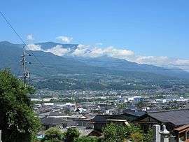
Panorama of Takagi Village
Takagi (喬木村 Takagi-mura) is a village located in Nagano Prefecture, Japan. As of 1 October 2016, the village had an estimated population of 6,298, and a population density of 94.6 persons per km². Its total area is 66.61 square kilometres (25.72 sq mi).
Geography
Takagi is located in the Ina Valley mountainous southern of Nagano Prefecture. The Tenryū River runs through the village.
Surrounding municipalities
History
The area of present-day Takagi was part of ancient Shinano Province. The modern village was established on April 1, 1889 with the establishment of the municipalities system.
Transportation
Railway
- The village does not have any passenger railway service
Highway
- The village is not located on any national highway
External links

- Official Website (in Japanese)
| Core city | |
|---|---|
| Special city | |
| Cities | |
| Districts | |
This article is issued from
Wikipedia.
The text is licensed under Creative Commons - Attribution - Sharealike.
Additional terms may apply for the media files.