Ikeda, Nagano
| Ikeda 池田町 | |||
|---|---|---|---|
| Town | |||
 Ikeda Town Hall | |||
| |||
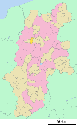 Location of Ikeda in Nagano Prefecture | |||
 Ikeda | |||
| Coordinates: 36°25′16.4″N 137°52′28.5″E / 36.421222°N 137.874583°ECoordinates: 36°25′16.4″N 137°52′28.5″E / 36.421222°N 137.874583°E | |||
| Country | Japan | ||
| Region | Chūbu (Kōshin'etsu) | ||
| Prefecture | Nagano | ||
| District | Kitaazumi | ||
| Area | |||
| • Total | 40.16 km2 (15.51 sq mi) | ||
| Population (October 2016) | |||
| • Total | 9,909 | ||
| • Density | 247/km2 (640/sq mi) | ||
| Time zone | UTC+9 (Japan Standard Time) | ||
| Symbols | |||
| • Tree | Pinus densiflora | ||
| • Flower | Azalea | ||
| Phone number | 0261-62-3131 | ||
| Address | 3203-6 Ikeda, Ikeda-machi, Kitaazumi-gun, Nagano-ken 399-8696 | ||
| Website | http://www.ikedamachi.net/ | ||


Ikeda (池田町 Ikeda-machi) is a town located in Nagano Prefecture, Japan. As of 1 October 2016, the town had an estimated population of 9,909, and a population density of 247 persons per km². Its total area is 40.16 square kilometres (15.51 sq mi). Ikeda is listed as one of The Most Beautiful Villages in Japan.[1]
Geography
Ikeda is located in north-central Nagano Prefecture.
Surrounding municipalities
History
The area of present-day Ikeda was part of ancient Shinano Province. The village of Ikedamachi was created with the establishment of the municipalities system on April 1, 1889. It was elevated to town status on April 1, 1915 as Ikeda. Ikeda annexed the neighboring village of Aisome on November 1,1955.
Education
Ikeda has two public elementary schools and one public middle school operated by the town government, and one public high school operated by the Nagano Prefectural Board of Education.
Transportation
Railway
- The town is not serviced by any passenger railway line
Highway
- The town is not on any national highway
References
- ↑ The Most Beautiful Villages in Japan (in Japanese)
External links

- Official Website (in Japanese)
| Core city | |
|---|---|
| Special city | |
| Cities | |
| Districts | |