Ogawa, Nagano
| Ogawa 小川村 | |||
|---|---|---|---|
| Village | |||
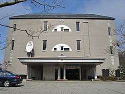 Ogawa Village Hall | |||
| |||
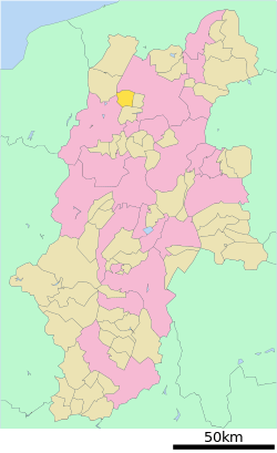 Location of Ogawa in Nagano Prefecture | |||
 Ogawa | |||
| Coordinates: 36°37′2″N 137°58′29″E / 36.61722°N 137.97472°ECoordinates: 36°37′2″N 137°58′29″E / 36.61722°N 137.97472°E | |||
| Country | Japan | ||
| Region | Chūbu (Kōshin'etsu) | ||
| Prefecture | Nagano | ||
| District | Kamiminochi | ||
| Area | |||
| • Total | 58.11 km2 (22.44 sq mi) | ||
| Population (October 2016) | |||
| • Total | 2,634 | ||
| • Density | 45.3/km2 (117/sq mi) | ||
| Time zone | UTC+9 (Japan Standard Time) | ||
| Symbols | |||
| Phone number | 026-269-2323 | ||
| Address | 8800-8 Takafu, Ogawa-mura, Kamiminochi-gun, Nagano-ken 381-3302 | ||
| Website | http://www.vill.ogawa.nagano.jp/ | ||


Ogawa (小川村 Ogawa-mura) is a village located in Nagano Prefecture, Japan. As of 1 October 2016, the village had an estimated population of 2,634, and a population density of 45.3 persons per km². Its total area is 58.11 square kilometres (22.44 sq mi). Ogawa is listed as one of The Most Beautiful Villages in Japan.[1]
Geography
Ogawa is located in northern Nagano Prefecture.
Surrounding municipalities
History
The area of present-day Ogawa was part of ancient Shinano Province. The villages of Kita-Ogawa and Minami-Ogawa were created with the establishment of the municipalities system on April 1, 1889. The two villages merged to form the village of Ogawa on April 1, 1955..
Economy
The economy of Ogawa is agricultural, primarily rice cultivation and horticulture.
Education
Ogawa has one public elementary school and one public middle school operated by the village government. The village does not have a high school.
Transportation
Railway
- Ogawa does not have any passenger railway service.
Highway
Local attractions
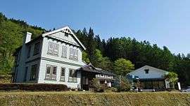
- Furusato Land Ogawa, local history museum
References
- ↑ The Most Beautiful Villages in Japan (in Japanese)
External links

- Official Website (in Japanese)
| Core city | |
|---|---|
| Special city | |
| Cities | |
| Districts | |