Agematsu, Nagano
| Agematsu 上松町 | |||
|---|---|---|---|
| Town | |||
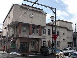 Agematsu Town Hall | |||
| |||
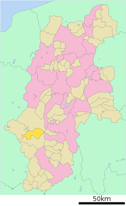 Location of Agematsu in Nagano Prefecture | |||
 Agematsu | |||
| Coordinates: 35°47′2.6″N 137°41′39.2″E / 35.784056°N 137.694222°ECoordinates: 35°47′2.6″N 137°41′39.2″E / 35.784056°N 137.694222°E | |||
| Country | Japan | ||
| Region | Chūbu (Kōshin'etsu) | ||
| Prefecture | Nagano | ||
| District | Kiso | ||
| Area | |||
| • Total | 168.42 km2 (65.03 sq mi) | ||
| Population (October 2016) | |||
| • Total | 4,612 | ||
| • Density | 27.4/km2 (71/sq mi) | ||
| Time zone | UTC+9 (Japan Standard Time) | ||
| Symbols | |||
| • Tree | Chamaecyparis obtusa | ||
| • Flower | Magnolia sieboldii, Lilium | ||
| • Bird | Japanese robin | ||
| Phone number | 0264-52-2001 | ||
| Address | 2-13 Eki-mae dori, Agematsu-machi, Kiso-gun, Nagano-ken 399-5603 | ||
| Website | http://www.town.agematsu.nagano.jp/ | ||


Agematsu (上松町 Agematsu-machi) is a town located in Nagano Prefecture, Japan. As of 1 October 2016, the town had an estimated population of 4,612, and a population density of 27.4 persons per km². Its total area is 168.42 square kilometres (65.03 sq mi).
Geography
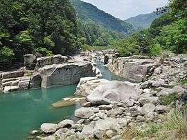
Agematsu is located in the Kiso Mountains of south-western Nagano Prefecture, bordered by the Kiso Mountains to the north. The Kiso River flows through the town.
Surrounding municipalities
History
The area of present-day Agematsu was part of ancient Shinano Province. Agematsu-juku developed as a post station on the Nakasendō highway connected Edo with Kyoto in the Edo period. The modern village of Komagane was established on April 1, 1889 by the establishment of the municipalities system. The village was divided into the towns of Komagane and Agematsu on September 3, 1922.
Transportation
Railway
Highway
Notable People
- Mitakeumi Hisashi professional sumo wrestler
External links

- Official Website (in Japanese)
| Authority control |
|---|
| Core city | |
|---|---|
| Special city | |
| Cities | |
| Districts | |