Sakuho, Nagano
| Sakuho 佐久穂町 | |||
|---|---|---|---|
| Town | |||
 Sakuho Town Hall | |||
| |||
 Location of Sakuho in Nagano Prefecture | |||
 Sakuho | |||
| Coordinates: 36°9′39.5″N 138°29′0.1″E / 36.160972°N 138.483361°ECoordinates: 36°9′39.5″N 138°29′0.1″E / 36.160972°N 138.483361°E | |||
| Country | Japan | ||
| Region | Chūbu (Kōshin'etsu) | ||
| Prefecture | Nagano | ||
| District | Minamisaku | ||
| Area | |||
| • Total | 188.15 km2 (72.65 sq mi) | ||
| Population (October 2016) | |||
| • Total | 11,091 | ||
| • Density | 58.9/km2 (153/sq mi) | ||
| Time zone | UTC+9 (Japan Standard Time) | ||
| Symbols | |||
| Phone number | 0267-86-2525 | ||
| Address | 569 Takano-machi, Sakuho-machi, Minamisaku-gun, Nagano-ken 384-0697 | ||
| Website | http://www.town.sakuho.nagano.jp/ | ||


Sakuho (佐久穂町 Sakuho-machi) is a town located in Nagano Prefecture, Japan. As of 1 October 2016, the town had an estimated population of 11,091, and a population density of 58.9 persons per km². Its total area is 188.15 square kilometres (72.65 sq mi).
Geography

Located in eastern Nagano prefecture, Sakuho stretches from west to east. It is situated in the Saku Basin, between the high peaks Mount Arafune and Mount Tateshina. The Shinano River flows through, and the mountainous parts of the town are located in the Yatsugatake-Chushin Kogen Quasi-National Park and the Myogi-Arafune-Saku Kogen Quasi-National Park.
- Mountains: Mount Morai
- Rivers: Chikuma River, Ōishi River, Nukui River
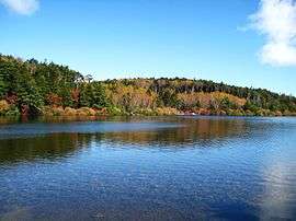
- Lakes: Futago Pond, Shirakoma Pond
Surrounding municipalities
History
The area of present-day Sakuho was part of ancient Shinano Province. The modern town of Sakuho was created by the merger of the town of Saku and the village of Yachiho on March 20, 2005.
Education
Sakuho has one public elementary school and one public middle school operated by the city government. The town does not have a high school.
Transportation
Railway
- JR East – Koumi Line
- Haguroshita - Aonuma - Usuda - Tatsuokajō
Highway
Local attractions
External links

- Official Website (in Japanese)
| Core city | |
|---|---|
| Special city | |
| Cities | |
| Districts | |