Miyota, Nagano
| Miyota 御代田 | |||
|---|---|---|---|
| Town | |||
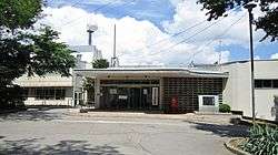 Miyota Town Hall | |||
| |||
 Location of Miyota in Nagano Prefecture | |||
 Miyota | |||
| Coordinates: 36°19′16.3″N 138°30′31.6″E / 36.321194°N 138.508778°ECoordinates: 36°19′16.3″N 138°30′31.6″E / 36.321194°N 138.508778°E | |||
| Country | Japan | ||
| Region | Chūbu (Kōshin'etsu) | ||
| Prefecture | Nagano | ||
| District | Kitasaku | ||
| Area | |||
| • Total | 58.76 km2 (22.69 sq mi) | ||
| Population (October 2016) | |||
| • Total | 15,151 | ||
| • Density | 258/km2 (670/sq mi) | ||
| Time zone | UTC+9 (Japan Standard Time) | ||
| Symbols | |||
| • Tree | Taxus cuspidata | ||
| • Flower | Lilium auratum | ||
| Phone number | 0267-32-3111 | ||
| Address | 2464-1 Miyota, Miyota-machi, Kitasaku-gun, Nagano-ken 389-0292 | ||
| Website | http://www.town.miyota.nagano.jp/ | ||


Miyota (御代田町 Miyota-machi) is a town located in Nagano Prefecture, Japan. As of 1 October 2016, the town had an estimated population of 15,151, and a population density of 258 persons per km². Its total area is 58.79 square kilometres (22.70 sq mi).
Geography
Miyota is located on the eastern border of Nagano Prefecture with Gumma Prefecture. Mount Asama (2568 meters) is within the town's northern borders.
Surrounding municipalities
- Nagano Prefecture
- Gumma Prefecture
History
The area of present-day Miyota was part of ancient Shinano Province, and was the site of the Battle of Odaihara during the Sengoku period. It developed as a post station on the Nakasendo highway connecting Edo with Kyoto during the Edo period
The modern village of Miyota was created with the establishment of the municipalities system on April 1, 1889. It merged with the villages of Onuma and Goka to form the town on Miyota on September 30, 1956.
Politics and government
Miyota is governed by a town council with 14 members. The current mayor, is a member of the Japanese Communist Party.
Elections
Education
Miyota has two public elementary schools and one public middle school operated by the town government. The town does not have a high school.
Transportation
Railway
Highway
Local attractions
- Otai-shuku, post station on the Nakasendo
- Mount Asama
External links

- Official Website (in Japanese)
| Core city | |
|---|---|
| Special city | |
| Cities | |
| Districts | |