Saint-Pancré
| Saint-Pancré | ||
|---|---|---|
| Commune | ||
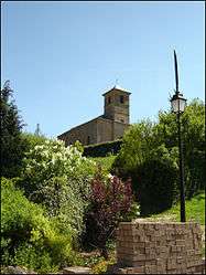 The church | ||
| ||
 Saint-Pancré Location within Grand Est region  Saint-Pancré | ||
| Coordinates: 49°31′48″N 5°38′56″E / 49.53°N 5.6489°ECoordinates: 49°31′48″N 5°38′56″E / 49.53°N 5.6489°E | ||
| Country | France | |
| Region | Grand Est | |
| Department | Meurthe-et-Moselle | |
| Arrondissement | Briey | |
| Canton | Mont-Saint-Martin | |
| Intercommunality | Deux Rivières | |
| Government | ||
| • Mayor (2008–2014) | Bernard Brunette | |
| Area1 | 6.13 km2 (2.37 sq mi) | |
| Population (1999)2 | 283 | |
| • Density | 46/km2 (120/sq mi) | |
| Time zone | UTC+1 (CET) | |
| • Summer (DST) | UTC+2 (CEST) | |
| INSEE/Postal code | 54485 /54730 | |
| Elevation |
230–400 m (750–1,310 ft) (avg. 260 m or 850 ft) | |
|
1 French Land Register data, which excludes lakes, ponds, glaciers > 1 km2 (0.386 sq mi or 247 acres) and river estuaries. 2 Population without double counting: residents of multiple communes (e.g., students and military personnel) only counted once. | ||

Saint-Pancré is a commune in the Meurthe-et-Moselle department in north-eastern France.
See also
References
| Wikimedia Commons has media related to Saint-Pancré. |
This article is issued from
Wikipedia.
The text is licensed under Creative Commons - Attribution - Sharealike.
Additional terms may apply for the media files.