Glonville
| Glonville | |
|---|---|
| Commune | |
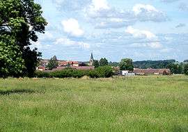 Vue générale, en venant de Fontenoy-la-Joûte | |
 Glonville Location within Grand Est region  Glonville | |
| Coordinates: 48°28′29″N 6°41′28″E / 48.4747°N 6.6911°ECoordinates: 48°28′29″N 6°41′28″E / 48.4747°N 6.6911°E | |
| Country | France |
| Region | Grand Est |
| Department | Meurthe-et-Moselle |
| Arrondissement | Lunéville |
| Canton | Baccarat |
| Intercommunality | Communauté de communes d'entre Meurthe et Verdurette |
| Government | |
| • Mayor (2001–2008) | Jean-Michel Petit |
| Area1 | 18.58 km2 (7.17 sq mi) |
| Population (2006)2 | 333 |
| • Density | 18/km2 (46/sq mi) |
| Time zone | UTC+1 (CET) |
| • Summer (DST) | UTC+2 (CEST) |
| INSEE/Postal code | 54229 /54122 |
| Elevation | 251–353 m (823–1,158 ft) |
|
1 French Land Register data, which excludes lakes, ponds, glaciers > 1 km2 (0.386 sq mi or 247 acres) and river estuaries. 2 Population without double counting: residents of multiple communes (e.g., students and military personnel) only counted once. | |
Glonville is a commune in the Meurthe-et-Moselle department in north-eastern France.
See also
| Wikimedia Commons has media related to Glonville. |
This article is issued from
Wikipedia.
The text is licensed under Creative Commons - Attribution - Sharealike.
Additional terms may apply for the media files.