Domjevin
| Domjevin | |
|---|---|
| Commune | |
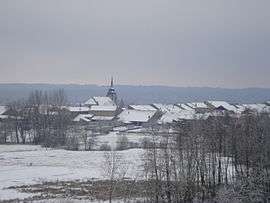 The village of Domjevin in the snow | |
 Domjevin Location within Grand Est region  Domjevin | |
| Coordinates: 48°34′37″N 6°41′51″E / 48.5769°N 6.6975°ECoordinates: 48°34′37″N 6°41′51″E / 48.5769°N 6.6975°E | |
| Country | France |
| Region | Grand Est |
| Department | Meurthe-et-Moselle |
| Arrondissement | Lunéville |
| Canton | Baccarat |
| Intercommunality | Communauté de communes de la Vezouze |
| Government | |
| • Mayor (2008–2014) | Lucien Manonviller |
| Area1 | 10.28 km2 (3.97 sq mi) |
| Population (1999)2 | 267 |
| • Density | 26/km2 (67/sq mi) |
| Demonym(s) | Domjevinois , Domjevinoise |
| Time zone | UTC+1 (CET) |
| • Summer (DST) | UTC+2 (CEST) |
| INSEE/Postal code | 54163 /54450 |
| Elevation |
237–293 m (778–961 ft) (avg. 200 m or 660 ft) |
|
1 French Land Register data, which excludes lakes, ponds, glaciers > 1 km2 (0.386 sq mi or 247 acres) and river estuaries. 2 Population without double counting: residents of multiple communes (e.g., students and military personnel) only counted once. | |
Domjevin is a commune in the Meurthe-et-Moselle department in north-eastern France.
See also
| Wikimedia Commons has media related to Domjevin. |
This article is issued from
Wikipedia.
The text is licensed under Creative Commons - Attribution - Sharealike.
Additional terms may apply for the media files.