Tantonville
| Tantonville | |
|---|---|
| Commune | |
 | |
 Tantonville Location within Grand Est region  Tantonville | |
| Coordinates: 48°28′11″N 6°08′23″E / 48.4697°N 6.1397°ECoordinates: 48°28′11″N 6°08′23″E / 48.4697°N 6.1397°E | |
| Country | France |
| Region | Grand Est |
| Department | Meurthe-et-Moselle |
| Arrondissement | Nancy |
| Canton | Meine au Saintois |
| Intercommunality | Communauté de communes du Saintois |
| Government | |
| • Mayor (2008–2014) | Serge Petitdant |
| Area1 | 8.09 km2 (3.12 sq mi) |
| Population (2012)2 | 653 |
| • Density | 81/km2 (210/sq mi) |
| Time zone | UTC+1 (CET) |
| • Summer (DST) | UTC+2 (CEST) |
| INSEE/Postal code | 54513 /54116 |
| Elevation |
246–327 m (807–1,073 ft) (avg. 305 m or 1,001 ft) |
|
1 French Land Register data, which excludes lakes, ponds, glaciers > 1 km2 (0.386 sq mi or 247 acres) and river estuaries. 2 Population without double counting: residents of multiple communes (e.g., students and military personnel) only counted once. | |
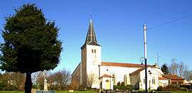
Tantonville is a commune in the Meurthe-et-Moselle department in north-eastern France.
See also
| Wikimedia Commons has media related to Tantonville. |
This article is issued from
Wikipedia.
The text is licensed under Creative Commons - Attribution - Sharealike.
Additional terms may apply for the media files.