Hussigny-Godbrange
| Hussigny-Godbrange | ||
|---|---|---|
| Commune | ||
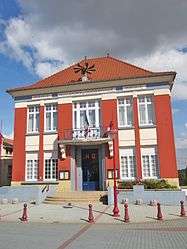 The town hall | ||
| ||
 Hussigny-Godbrange Location within Grand Est region  Hussigny-Godbrange | ||
| Coordinates: 49°29′37″N 5°52′30″E / 49.4936°N 5.875°ECoordinates: 49°29′37″N 5°52′30″E / 49.4936°N 5.875°E | ||
| Country | France | |
| Region | Grand Est | |
| Department | Meurthe-et-Moselle | |
| Arrondissement | Briey | |
| Canton | Villerupt | |
| Intercommunality | Communauté d'agglomération de Longwy | |
| Government | ||
| • Mayor (2008–2013) | Laurent Righi | |
| Area1 | 15.37 km2 (5.93 sq mi) | |
| Population (2004)2 | 3,142 | |
| • Density | 200/km2 (530/sq mi) | |
| Time zone | UTC+1 (CET) | |
| • Summer (DST) | UTC+2 (CEST) | |
| INSEE/Postal code | 54270 /54590 | |
| Elevation |
275–445 m (902–1,460 ft) (avg. 423 m or 1,388 ft) | |
| Website | www.mairiehussignygodbrange.fr | |
|
1 French Land Register data, which excludes lakes, ponds, glaciers > 1 km2 (0.386 sq mi or 247 acres) and river estuaries. 2 Population without double counting: residents of multiple communes (e.g., students and military personnel) only counted once. | ||

Hussigny-Godbrange (Luxembourgish: Héiséng-Gueberéng, German: Hussingen-Godbringen) is a commune in the Meurthe-et-Moselle department in north-eastern France.
It lies near the border with Luxembourg.
Hussigny-Godbrange is a historic center of Italian immigration in France. Therefore, it was called "Little Italy."
See also
| Wikimedia Commons has media related to Hussigny-Godbrange. |
This article is issued from
Wikipedia.
The text is licensed under Creative Commons - Attribution - Sharealike.
Additional terms may apply for the media files.