Saint-Léger-la-Montagne
| Saint-Léger-la-Montagne | |
|---|---|
| Commune | |
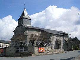 The church in Saint-Léger-la-Montagne | |
 Saint-Léger-la-Montagne Location within Nouvelle-Aquitaine region  Saint-Léger-la-Montagne | |
| Coordinates: 46°01′50″N 1°25′12″E / 46.0306°N 1.42000°ECoordinates: 46°01′50″N 1°25′12″E / 46.0306°N 1.42000°E | |
| Country | France |
| Region | Nouvelle-Aquitaine |
| Department | Haute-Vienne |
| Arrondissement | Limoges |
| Canton | Ambazac |
| Intercommunality | Porte d'Occitanie |
| Government | |
| • Mayor (2008–2014) | Claude Pérucaud |
| Area1 | 32.62 km2 (12.59 sq mi) |
| Population (2006)2 | 326 |
| • Density | 10.0/km2 (26/sq mi) |
| Time zone | UTC+1 (CET) |
| • Summer (DST) | UTC+2 (CEST) |
| INSEE/Postal code | 87159 /87340 |
| Elevation | 418–701 m (1,371–2,300 ft) |
|
1 French Land Register data, which excludes lakes, ponds, glaciers > 1 km2 (0.386 sq mi or 247 acres) and river estuaries. 2 Population without double counting: residents of multiple communes (e.g., students and military personnel) only counted once. | |
Saint-Léger-la-Montagne (Occitan: Sent Legèr) is a commune in the Haute-Vienne department in the Nouvelle-Aquitaine region in west-central France.
Inhabitants are known as Saint-Légeois.
See also
References
| Wikimedia Commons has media related to Saint-Léger-la-Montagne. |
This article is issued from
Wikipedia.
The text is licensed under Creative Commons - Attribution - Sharealike.
Additional terms may apply for the media files.