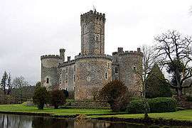
Dournazac
| Dournazac | ||
|---|---|---|
| Commune | ||
 | ||
| ||
 Dournazac Location within Nouvelle-Aquitaine region  Dournazac | ||
| Coordinates: 45°37′33″N 0°55′02″E / 45.6258°N 0.9172°ECoordinates: 45°37′33″N 0°55′02″E / 45.6258°N 0.9172°E | ||
| Country | France | |
| Region | Nouvelle-Aquitaine | |
| Department | Haute-Vienne | |
| Arrondissement | Rochechouart | |
| Canton | Rochechouart | |
| Intercommunality | Monts de Châlus | |
| Government | ||
| • Mayor (2014–2020) | Christian Bonnat | |
| Area1 | 35.97 km2 (13.89 sq mi) | |
| Population (2006)2 | 719 | |
| • Density | 20/km2 (52/sq mi) | |
| Time zone | UTC+1 (CET) | |
| • Summer (DST) | UTC+2 (CEST) | |
| INSEE/Postal code | 87060 /87230 | |
| Elevation | 288–498 m (945–1,634 ft) | |
|
1 French Land Register data, which excludes lakes, ponds, glaciers > 1 km2 (0.386 sq mi or 247 acres) and river estuaries. 2 Population without double counting: residents of multiple communes (e.g., students and military personnel) only counted once. | ||
.svg.png)
Dournazac (Occitan: Dornasac) is a commune in the Haute-Vienne department in the Nouvelle-Aquitaine region in western France.
Inhabitants are known as Dournazacois.
See also
References
| Wikimedia Commons has media related to Dournazac. |
This article is issued from
Wikipedia.
The text is licensed under Creative Commons - Attribution - Sharealike.
Additional terms may apply for the media files.