Le Châtenet-en-Dognon
| Le Châtenet-en-Dognon | |
|---|---|
| Commune | |
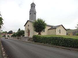 The church in Le Châtenet-en-Dognon | |
 Le Châtenet-en-Dognon Location within Nouvelle-Aquitaine region  Le Châtenet-en-Dognon | |
| Coordinates: 45°54′24″N 1°30′25″E / 45.9067°N 1.5069°ECoordinates: 45°54′24″N 1°30′25″E / 45.9067°N 1.5069°E | |
| Country | France |
| Region | Nouvelle-Aquitaine |
| Department | Haute-Vienne |
| Arrondissement | Limoges |
| Canton | Saint-Léonard-de-Noblat |
| Intercommunality | Noblat |
| Government | |
| • Mayor (2008–2014) | Hervé Valadas |
| Area1 | 20.39 km2 (7.87 sq mi) |
| Population (2006)2 | 418 |
| • Density | 21/km2 (53/sq mi) |
| Time zone | UTC+1 (CET) |
| • Summer (DST) | UTC+2 (CEST) |
| INSEE/Postal code | 87042 /87400 |
| Elevation | 271–457 m (889–1,499 ft) |
|
1 French Land Register data, which excludes lakes, ponds, glaciers > 1 km2 (0.386 sq mi or 247 acres) and river estuaries. 2 Population without double counting: residents of multiple communes (e.g., students and military personnel) only counted once. | |
Le Châtenet-en-Dognon (Occitan: Lo Chastanèt) is a commune in the Haute-Vienne department in the Nouvelle-Aquitaine region in western France.
See also
References
| Wikimedia Commons has media related to Le Châtenet-en-Dognon. |
This article is issued from
Wikipedia.
The text is licensed under Creative Commons - Attribution - Sharealike.
Additional terms may apply for the media files.