Bujaleuf
| Bujaleuf | ||
|---|---|---|
| Commune | ||
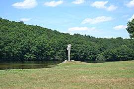 The Sainte-Hélène Lake, in Bujaleuf | ||
| ||
 Bujaleuf Location within Nouvelle-Aquitaine region  Bujaleuf | ||
| Coordinates: 45°47′51″N 1°37′50″E / 45.79750°N 1.6306°ECoordinates: 45°47′51″N 1°37′50″E / 45.79750°N 1.6306°E | ||
| Country | France | |
| Region | Nouvelle-Aquitaine | |
| Department | Haute-Vienne | |
| Arrondissement | Limoges | |
| Canton | Eymoutiers | |
| Intercommunality | Portes de Vassivière | |
| Government | ||
| • Mayor (2008–2014) | Alain Dolley | |
| Area1 | 41.17 km2 (15.90 sq mi) | |
| Population (2006)2 | 916 | |
| • Density | 22/km2 (58/sq mi) | |
| Time zone | UTC+1 (CET) | |
| • Summer (DST) | UTC+2 (CEST) | |
| INSEE/Postal code | 87024 /87460 | |
| Elevation | 290–536 m (951–1,759 ft) | |
|
1 French Land Register data, which excludes lakes, ponds, glaciers > 1 km2 (0.386 sq mi or 247 acres) and river estuaries. 2 Population without double counting: residents of multiple communes (e.g., students and military personnel) only counted once. | ||
.svg.png)
Bujaleuf (Occitan: Bujaleu) is a commune in the Haute-Vienne department in the Nouvelle-Aquitaine region in western France.
See also
References
| Wikimedia Commons has media related to Bujaleuf. |
| Authority control |
|---|
This article is issued from
Wikipedia.
The text is licensed under Creative Commons - Attribution - Sharealike.
Additional terms may apply for the media files.