Sainte-Anne-Saint-Priest
| Sainte-Anne-Saint-Priest | |
|---|---|
| Commune | |
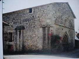 The church-priory of Villevaleix, in Sainte-Anne-Saint-Priest | |
 Sainte-Anne-Saint-Priest Location within Nouvelle-Aquitaine region  Sainte-Anne-Saint-Priest | |
| Coordinates: 45°42′33″N 1°41′01″E / 45.7092°N 1.6836°ECoordinates: 45°42′33″N 1°41′01″E / 45.7092°N 1.6836°E | |
| Country | France |
| Region | Nouvelle-Aquitaine |
| Department | Haute-Vienne |
| Arrondissement | Limoges |
| Canton | Eymoutiers |
| Intercommunality | Portes de Vassivière |
| Government | |
| • Mayor (2008–2014) | Henri Buxeraud |
| Area1 | 16.54 km2 (6.39 sq mi) |
| Population (2006)2 | 161 |
| • Density | 9.7/km2 (25/sq mi) |
| Time zone | UTC+1 (CET) |
| • Summer (DST) | UTC+2 (CEST) |
| INSEE/Postal code | 87134 /87120 |
| Elevation | 372–638 m (1,220–2,093 ft) |
|
1 French Land Register data, which excludes lakes, ponds, glaciers > 1 km2 (0.386 sq mi or 247 acres) and river estuaries. 2 Population without double counting: residents of multiple communes (e.g., students and military personnel) only counted once. | |
Sainte-Anne-Saint-Priest (Occitan: Senta Anna-Sent Príech) is a commune in the Haute-Vienne department in the Nouvelle-Aquitaine region in west-central France.
See also
References
| Wikimedia Commons has media related to Sainte-Anne-Saint-Priest. |
This article is issued from
Wikipedia.
The text is licensed under Creative Commons - Attribution - Sharealike.
Additional terms may apply for the media files.