Aureil
| Aureil | ||
|---|---|---|
| Commune | ||
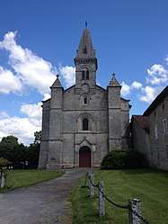 Saint-Gaucher Church, Aureil | ||
| ||
 Aureil Location within Nouvelle-Aquitaine region  Aureil | ||
| Coordinates: 45°48′24″N 1°23′36″E / 45.8067°N 1.3933°ECoordinates: 45°48′24″N 1°23′36″E / 45.8067°N 1.3933°E | ||
| Country | France | |
| Region | Nouvelle-Aquitaine | |
| Department | Haute-Vienne | |
| Arrondissement | Limoges | |
| Canton | Saint-Léonard-de-Noblat | |
| Intercommunality | CA Limoges Métropole | |
| Government | ||
| • Mayor (2014-2020) | Bernard Thalamy | |
| Area1 | 10.17 km2 (3.93 sq mi) | |
| Population (2015)2 | 993 | |
| • Density | 98/km2 (250/sq mi) | |
| Time zone | UTC+1 (CET) | |
| • Summer (DST) | UTC+2 (CEST) | |
| INSEE/Postal code | 87005 /87220 | |
| Elevation | 330–481 m (1,083–1,578 ft) | |
|
1 French Land Register data, which excludes lakes, ponds, glaciers > 1 km2 (0.386 sq mi or 247 acres) and river estuaries. 2 Population without double counting: residents of multiple communes (e.g., students and military personnel) only counted once. | ||
.svg.png)
Aureil (Occitan: Aurèlh) is a commune in the Haute-Vienne department in the Nouvelle-Aquitaine region in western France.
Hamlets
- Main village with its town hall, school and church
- Bost-Las-Mongeas: about 20 houses, mainly old, and an old chapel now part of a farm
- Couderchoux: about 6 old houses
See also
References
External links
| Wikimedia Commons has media related to Aureil. |
- Official website (in French)
| Authority control |
|---|
This article is issued from
Wikipedia.
The text is licensed under Creative Commons - Attribution - Sharealike.
Additional terms may apply for the media files.