Goodeve, Saskatchewan
| Goodeve | |
|---|---|
| Village | |
| Village of Goodeve | |
 Location of Goodeve in Saskatchewan  Goodeve, Saskatchewan (Canada) | |
| Coordinates: 51°06′54″N 103°02′42″W / 51.115°N 103.045°W | |
| Country |
|
| Province |
|
| Region | East-central |
| Census division | 6 |
| Rural Municipality | Stanley No. 215 |
| Post office Founded | 1909 |
| Government | |
| • Type | Municipal |
| • Governing body | Goodeve Village Council |
| • Mayor | Craig Sawchuk |
| • Administrator | Angela Romanson |
| Area | |
| • Total | 2.62 km2 (1.01 sq mi) |
| Population (2016) | |
| • Total | 40 |
| • Density | 15.3/km2 (40/sq mi) |
| Time zone | UTC-6 (CST) |
| Postal code | S0A 1C0 |
| Area code(s) | 306 |
| Highways |
|
| Railways | Canadian National Railway |
| [1][2][3][4] | |
Goodeve is a village within the Rural Municipality of Stanley No. 215, in the province of Saskatchewan, Canada. The village is the administrative headquarters of the Little Black Bear Cree First Nation band government. The village had a population of 40 in the 2016 Canada Census, (a -11.1% decrease from 45 in the 2011 Canada Census).
Demographics
| Canada census – Goodeve, Saskatchewan community profile | |||
|---|---|---|---|
| 2016 | 2011 | 2006 | |
| Population: | 40 (-11.1% from 2011) | 45 (-10.0% from 2006) | 50 (-28.6% from 2001) |
| Land area: | 2.62 km2 (1.01 sq mi) | 2.62 km2 (1.01 sq mi) | 2.62 km2 (1.01 sq mi) |
| Population density: | 15.4/km2 (40/sq mi) | 17.2/km2 (45/sq mi) | 19.1/km2 (49/sq mi) |
| Median age: | 59.5 (M: 62.0, F: 56.5) | 53.5 (M: 56.5, F: 51.0) | 57.0 (M: 54.7, F: 60.5) |
| Total private dwellings: | 34 | 29 | 46 |
| Median household income: | $Not Available | ||
| References: 2016[5] 2011[6] 2006[7] earlier[8] | |||
Notable residents
- Todd McLellan (former resident) - Coach of the NHL's Edmonton Oilers.
John R. Kowalchuk (former resident) - Minister of Tourism and Renewable Resources in Saskatchewan Legislation.
See also
References
- ↑ National Archives, Archivia Net, Post Offices and Postmasters, archived from the original on 2006-10-06
- ↑ Government of Saskatchewan, MRD Home, Municipal Directory System, archived from the original (– Scholar search) on November 21, 2008
- ↑ Canadian Textiles Institute. (2005), CTI Determine your provincial constituency, archived from the original on 2007-09-11
- ↑ Commissioner of Canada Elections, Chief Electoral Officer of Canada (2005), Elections Canada On-line, archived from the original on 2007-04-21
- ↑ "2016 Community Profiles". Canada 2016 Census. Statistics Canada. February 21, 2017. Retrieved 2017-03-15.
- ↑ "2011 Community Profiles". Canada 2011 Census. Statistics Canada. July 5, 2013. Retrieved 2012-10-30.
- ↑ "2006 Community Profiles". Canada 2006 Census. Statistics Canada. March 30, 2011. Retrieved 2009-02-24.
- ↑ "2001 Community Profiles". Canada 2001 Census. Statistics Canada. February 17, 2012.
External links
- Saskatchewan City & Town Maps
- Saskatchewan Gen Web - One Room School Project
- Post Offices and Postmasters - ArchiviaNet - Library and Archives Canada
- Saskatchewan Gen Web Region
- Online Historical Map Digitization Project
- GeoNames Query
- 2006 Community Profiles
| Subdivisions | |
|---|---|
| Communities | |
| Cities | |
| Topics |
|
| |
| Cities | 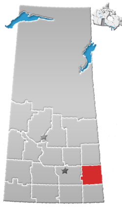 | ||
|---|---|---|---|
| Towns | |||
| Villages | |||
| Resort villages | |||
| Rural municipalities | |||
| First Nations | |||
| Indian reserves | |||
| Unincorporated communities |
| ||
Coordinates: 51°06′54″N 103°02′42″W / 51.115°N 103.045°W
This article is issued from
Wikipedia.
The text is licensed under Creative Commons - Attribution - Sharealike.
Additional terms may apply for the media files.