Sandyville, West Virginia
| Sandyville | |
|---|---|
| Unincorporated community | |
 Sandyville Location within the state of West Virginia  Sandyville Sandyville (the US) | |
| Coordinates: 38°54′21″N 81°39′38″W / 38.90583°N 81.66056°WCoordinates: 38°54′21″N 81°39′38″W / 38.90583°N 81.66056°W | |
| Country | United States |
| State | West Virginia |
| County | Jackson |
| Time zone | UTC-5 (Eastern (EST)) |
| • Summer (DST) | UTC-4 (EDT) |
| ZIP codes | 25275 |
Sandyville is an unincorporated community in north central Jackson County, West Virginia, United States. It lies close to the left fork of Sandy Creek, nestled in the hills between Ravenswood and Ripley.[1] It has a population of 1,721 and an average household income of $41,122.[2]
The community was named after nearby Sandy Creek.[3]
Climate
The climate in this area is characterized by hot, humid summers and generally mild to cool winters. According to the Köppen Climate Classification system, Sandyville has a humid subtropical climate, abbreviated "Cfa" on climate maps.[4]
References
- ↑ Sandyville, West Virginia (25275) Conditions & Forecast : Weather Underground
- ↑ Sandyville Schools
- ↑ Kenny, Hamill (1945). West Virginia Place Names: Their Origin and Meaning, Including the Nomenclature of the Streams and Mountains. Piedmont, WV: The Place Name Press. p. 554.
- ↑ Climate Summary for Sandyville, West Virginia
Municipalities and communities of Jackson County, West Virginia, United States | ||
|---|---|---|
| Cities | 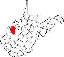 | |
| Unincorporated communities |
| |
| Ghost towns | ||
| Footnotes | ‡This populated place also has portions in an adjacent county or counties | |
This article is issued from
Wikipedia.
The text is licensed under Creative Commons - Attribution - Sharealike.
Additional terms may apply for the media files.