Meadowdale, Jackson County, West Virginia
| Meadowdale, West Virginia | |
|---|---|
| Unincorporated community | |
 Meadowdale, West Virginia  Meadowdale, West Virginia | |
| Coordinates: 38°53′51″N 81°36′01″W / 38.89750°N 81.60028°WCoordinates: 38°53′51″N 81°36′01″W / 38.89750°N 81.60028°W | |
| Country | United States |
| State | West Virginia |
| County | Jackson |
| Elevation | 627 ft (191 m) |
| Time zone | UTC-5 (Eastern (EST)) |
| • Summer (DST) | UTC-4 (EDT) |
| Area code(s) | 304 & 681 |
| GNIS feature ID | 1549816[1] |
Meadowdale is an unincorporated community in Jackson County, West Virginia, United States. Meadowdale is located on County Route 13 and the Right Fork Sandy Creek 8.1 miles (13.0 km) northeast of Ripley.[2] Meadowdale once had a post office, which is now closed.[3]
References
- ↑ "Meadowdale". Geographic Names Information System. United States Geological Survey.
- ↑ Jackson County, West Virginia General Highway Map (PDF) (Map). West Virginia Department of Transportation. 2011. p. 2. Archived from the original (PDF) on April 25, 2012. Retrieved April 18, 2012.
- ↑ "Meadowdale Post Office (historical)". Geographic Names Information System. United States Geological Survey.
Municipalities and communities of Jackson County, West Virginia, United States | ||
|---|---|---|
| Cities | 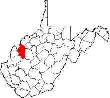 | |
| Unincorporated communities |
| |
| Ghost towns | ||
| Footnotes | ‡This populated place also has portions in an adjacent county or counties | |
This article is issued from
Wikipedia.
The text is licensed under Creative Commons - Attribution - Sharealike.
Additional terms may apply for the media files.