Plœuc-l'Hermitage
| Plœuc-l'Hermitage | |
|---|---|
| Commune | |
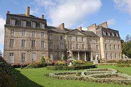 The château of Lorges | |
 Plœuc-l'Hermitage Location within Brittany region  Plœuc-l'Hermitage | |
| Coordinates: 48°20′49″N 2°45′22″W / 48.347°N 2.756°WCoordinates: 48°20′49″N 2°45′22″W / 48.347°N 2.756°W | |
| Country | France |
| Region | Brittany |
| Department | Côtes-d'Armor |
| Arrondissement | Saint-Brieuc |
| Canton | Plaintel |
| Area1 | 82.27 km2 (31.76 sq mi) |
| Population (2013)2 | 4,058 |
| • Density | 49/km2 (130/sq mi) |
| Time zone | UTC+1 (CET) |
| • Summer (DST) | UTC+2 (CEST) |
| INSEE/Postal code | 22203 /22150 |
|
1 French Land Register data, which excludes lakes, ponds, glaciers > 1 km2 (0.386 sq mi or 247 acres) and river estuaries. 2 Population without double counting: residents of multiple communes (e.g., students and military personnel) only counted once. | |
Plœuc-l'Hermitage is a commune in the Côtes-d'Armor department of western France. The municipality was established on 1 January 2016 and consists of the former communes of Plœuc-sur-Lié and L'Hermitage-Lorge.[1]
See also
References
| Wikimedia Commons has media related to Plœuc-L'Hermitage. |
- ↑ Arrêté préfectoral 30 November 2015 (in French)
This article is issued from
Wikipedia.
The text is licensed under Creative Commons - Attribution - Sharealike.
Additional terms may apply for the media files.