North Avenue, Quezon City
| ||||
|---|---|---|---|---|
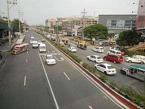 North Avenue looking east from its intersection with EDSA | ||||
| Major junctions | ||||
| North end | Epifanio de los Santos Avenue, Quezon City | |||
|
Vertis North Access Road Agham Road VMMC Access Road | ||||
| South end | Elliptical Road, Quezon City | |||
| Highway system | ||||
|
Roads in the Philippines
| ||||
.svg.png)
North Avenue is a street located in Quezon City within the Diliman area of northeastern Metro Manila, Philippines. It runs east–west through the northern edge of the barangay of North Triangle. The street is located in Quezon City's mixed-use and government area, known for its malls, condominiums, hotels, and the upcoming QC CBD.[1] It is also home to the SM City North EDSA, Trinoma, and Ayala Malls Vertis North located on the avenue's junction with Epifanio de los Santos Avenue (EDSA). The street is designated as a national road, numbered N173.
History
The avenue forms the northern boundary of the formerly proposed 400-hectare (990-acre) Diliman Quadrangle within the former Diliman Estate also known as Hacienda de Tuason, purchased by the Philippine Commonwealth government in 1939 as the new capital to replace Manila.[2] It was originally planned as the new city's Central Park housing the new national government buildings (the new Presidential palace, Capitol Building, and Supreme Court complex) within the 25-hectare (62-acre) elliptical site now known as the Quezon Memorial Circle. The quadrangle is bordered on the north by North Avenue, on the east by East Avenue, on the south by Timog (South) Avenue, and on the west by West Avenue. Designed by American city planner William E. Parsons and Harry Frost, in collaboration with engineer AD Williams and architects Juan Arellano and Louis Croft, the site was also to contain the 15-hectare (37-acre) national exposition grounds opposite the corner of North Avenue and EDSA (now occupied by SM City North Edsa shopping mall).[2] The Diliman Quadrangle had been largely undeveloped for decades due to lack of funding. After several revisions, the government planners moved the city center to Novaliches due to its higher elevation.[3] By 1976, the country's capital had been transferred back to Manila with only the Quezon Memorial built in the former capital site.
Description
North Avenue is a six-lane road located at the heart of Quezon City's mixed-use and government district. It begins at its junction with EDSA north of West Avenue by West Triangle's border with the central Diliman village of Pinyahan. It heads east from this junction to cross Mindanao Avenue towards Agham Road. Located on or near this western section of North are North Avenue Station, SM City North EDSA, Trinoma, Ayala Malls Vertis North, Seda Hotel Vertis North, Vertis North CBD. After crossing the Agham Road, the eastern section of the avenue is dominated by government establishments, including The Philippine Science High School, Bureau of Fire Protection National Headquarters, Office of the Ombudsman, , and Veterans Memorial Medical Center and Golf Complex, National Food Authority Office, Sugar Regulatory Administration Office, and the Ninoy Aquino Parks & Wildlife Center. The avenue terminates at the junction with Elliptical Road.
References
- ↑ "Business brings more fun in Quezon City". Quezon City Business. Retrieved 16 May 2015.
- 1 2 "The 1946 Quezon City world's fair". The Philippine Star. Retrieved 16 May 2015.
- ↑ "25 things you didn't know about Quezon City". The Philippine Star. Retrieved 16 May 2015.
Coordinates: 14°39′13″N 121°2′17″E / 14.65361°N 121.03806°E
| Wikimedia Commons has media related to North Avenue, Quezon City. |