Mount Marcy
| Mount Marcy | |
|---|---|
 Mount Marcy (photo taken from Mount Haystack, looking across Panther Gorge) | |
| Highest point | |
| Elevation | 5,343 ft (1,629 m) NAVD 88[1] |
| Prominence | 4,914 ft (1,498 m) [2] |
| Listing | |
| Coordinates | 44°06′46″N 73°55′25″W / 44.112734392°N 73.923725878°WCoordinates: 44°06′46″N 73°55′25″W / 44.112734392°N 73.923725878°W [1] |
| Geography | |
 Mount Marcy  Mount Marcy Mount Marcy (the US) | |
| Parent range | Adirondack Mountains |
| Topo map | USGS Mount Marcy |
| Climbing | |
| First ascent | August 8, 1837 by Ebenezer Emmons and party |
| Easiest route | Hike (Van Hoevenberg trail) |
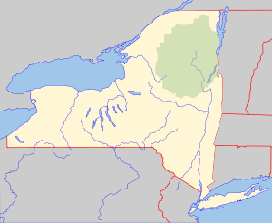
Mount Marcy (Mohawk: Tewawe’éstha[3]) is the highest point in New York State,[4] with an elevation of 5,343 feet (1,629 m).[1] and an isolation of 130 mile. It is located in the Town of Keene in Essex County. The mountain is in the heart of the Adirondack High Peaks Region of the High Peaks Wilderness Area. Its stature and expansive views make it a popular destination for hikers, who crowd its summit in the summer months.
Lake Tear of the Clouds, at the col between Mt. Marcy and Mt. Skylight, is often cited as the highest source of the Hudson River,[5] via Feldspar Brook and the Opalescent River, even though the main stem of the Opalescent River has as its source a higher point two miles north of Lake of the Clouds, and that stem is a mile longer than Feldspar Brook.
History
The mountain is named after Gov. William L. Marcy, the 19th-century Governor of New York, who authorized the environmental survey that explored the area. Its first recorded ascent was on August 5, 1837, by a large party led by Ebenezer Emmons looking for the source of the East Fork of the Hudson River.[6] Today the summit may be reached by multiple trails; though long by any route, a round-trip may be made in a day.
Vice President (and former governor) Theodore Roosevelt was at his hunting camp, Tahawus, on September 14, 1901, after summiting Marcy, when he was informed that President William McKinley, who had been shot a week earlier, had taken a serious turn for the worse.
Roosevelt and his party hiked ten miles (16 km) down the southwest face of the mountain to Long Lake, New York where he hired a stage coach to take him to the closest train station at North Creek. At some point along the route, Roosevelt learned that McKinley had died, and so Roosevelt took the train to Buffalo to get sworn in as President. The route from Long Lake to North Creek has been designated as the Roosevelt-Marcy Trail.
Routes
Mount Marcy is one of the High Peaks of the Adirondack Mountains. The majority of the mountain is forested, although the final few hundred feet is above the tree line. The peak is dominated by rocky outcrops, lichens, and alpine shrubs. There are two plaques at the top commemorating the centennial of the climb as well as the mountain summit itself.
The shortest and most frequently used route up the mountain is from the northwest, the Van Hoevenberg Trail, which starts at the Adirondak Loj near Heart Lake. From there it is 7.4 miles (11.2 km) to the summit, a lengthy 14.8-mile (22.4 km) roundtrip which can nevertheless be done in a day. A large section of the trail is suitable for alpine skiing and snowboarding.
The summit via the Johns Brook Trail from the Garden parking north of the mountain in Keene Valley is an 18-mile (28.8 km) round trip, which may be broken at Johns Brook Lodge.
A lengthier southern approach can be made from either of the two major trailheads for the southern High Peaks, Upper Works or Elk Lake.
Visibility on the summit occasionally affords very distant views of most of the Monteregian Hills volcano chain in Quebec's St Lawrence valley as far north as Mont St Hillaire. Views of Burlington and Lake Champlain adorn the surrounding Green Mountains with visibility extending far beyond the Southern Adirondacks as well.
Gallery
 Summit of Mount Marcy seen from near Little Marcy
 Mount Marcy summit
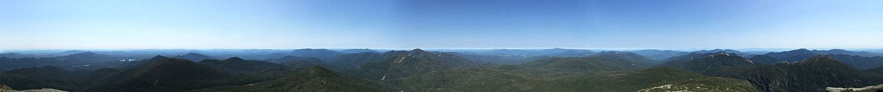
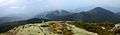 Mount Marcy Summit Panorama
 The summit may be rather crowded on summer holiday weekends
See also
References
- 1 2 3 "Marcy". NGS data sheet. U.S. National Geodetic Survey. Retrieved 2009-01-08.
- ↑ "Mount Marcy". Peakbagger.com. Retrieved 2009-01-08.
- ↑ "Haudenosaunee Country in Mohawk". 4 February 2015.
- ↑ "Elevations and Distances in the United States". United States Geological Survey. April 29, 2005. Retrieved 2009-03-28.
- ↑ "Natural History of the Hudson River". Hhr.highlands.com. Archived from the original on September 17, 2013. Retrieved February 16, 2014.
- ↑ "First reported trek up Mount Marcy occurred 175 years ago".
External links
- Mount Marcy hike and trip report. June 2010.