West Kill Mountain
| West Kill Mountain | |
|---|---|
 West Kill Mountain | |
| Highest point | |
| Elevation | 3880+ ft (1183+ m) NGVD 29[1] |
| Prominence | 1,220 ft (370 m) [1] |
| Listing | Catskill High Peaks |
| Coordinates | 42°10′04″N 74°17′23″W / 42.1678663°N 74.2895904°WCoordinates: 42°10′04″N 74°17′23″W / 42.1678663°N 74.2895904°W [2] |
| Geography | |
| Location | Greene County, New York |
| Parent range | Devil's Path |
| Topo map | USGS Lexington |
West Kill Mountain, or Westkill Mountain, is located in Greene County, New York. The mountain is named after the West Kill stream which flows along its northern side, and is part of the Devil's Path range of the Catskill Mountains. To the east, West Kill Mountain faces Southwest Hunter Mountain across 800-foot-deep (240 m) Diamond Notch; to the west, West Kill faces North Dome across Mink Hollow.
West Kill Mountain stands within the watershed of the Hudson River, which drains into New York Bay. The north slopes drain into the West Kill, thence into Schoharie Creek, the Mohawk River, and the Hudson River. The southeast slopes of the mountain drain into Hollow Tree Brook, thence into Stony Clove Creek, Esopus Creek, and the Hudson River. The southwest slopes of West Kill Mountain drain into the Broadstreet Hollow stream, thence into Esopus Creek.
West Kill Mountain is contained within the Westkill Mountain Wilderness Area of New York's Catskill State Park.
See also
References
- 1 2 "West Kill Mountain, New York". Peakbagger.com. Retrieved 2011-05-09.
- ↑ "West Kill Mountain". Geographic Names Information System. United States Geological Survey. Retrieved 2011-05-09.
External links
- "West Kill Mountain Hiking Info". Catskill 3500 Club. Retrieved 2011-05-09.
- "Summitpost.org: Westkill". SummitPost.org. Retrieved 2011-05-09.
- "Hunter-Westkill Wilderness Area". Department of Environmental Conservation. Retrieved 2011-05-31.
| Northwest Catskills | 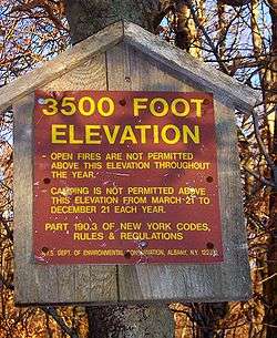 | |
|---|---|---|
| Blackhead Mountains | ||
| Other northeast Catskills | ||
| Devil's Path | ||
| Other central Catskills | ||
| Southwest Catskills | ||
| Burroughs Range | ||
| Other southern Catskills | ||