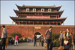
Honghe Hani and Yi Autonomous Prefecture
| Honghe Prefecture 红河州 | |
|---|---|
| Autonomous prefecture | |
|
红河哈尼族彝族自治州 Honghe Hani and Yi Autonomous Prefecture | |
 Location of Honghe Prefecture in Yunnan | |
| Country | People's Republic of China |
| Province | Yunnan |
| County-level division |
3 county-level cities 7 counties 3 autonomous counties |
| Prefecture established | 6 September 1957 |
| Prefecture seat | Mengzi |
| Area | |
| • Total | 32,929 km2 (12,714 sq mi) |
| Population | |
| • Total | 4,130,463 |
| • Density | 130/km2 (320/sq mi) |
| Time zone | UTC+8 (China Standard) |
| Postal code | 661400 |
| Area code(s) | 0873 |
| ISO 3166 code | CN-YN-25 |
| Licence plate prefixes | 云G |
| Website |
www |

| Honghe | |||||||||
| Traditional Chinese | 紅河 | ||||||||
|---|---|---|---|---|---|---|---|---|---|
| Simplified Chinese | 红河 | ||||||||
| Postal | Hungho | ||||||||
| |||||||||
| Honghe Hani and Yi Autonomous Prefecture | |||||||||
| Traditional Chinese | 紅河哈尼族彝族自治州 | ||||||||
|---|---|---|---|---|---|---|---|---|---|
| Simplified Chinese | 红河哈尼族彝族自治州 | ||||||||
| Postal | Hungho Hani and I Autonomous Prefecture | ||||||||
| |||||||||
Honghe Hani and Yi Autonomous Prefecture (simplified Chinese: 红河哈尼族彝族自治州; traditional Chinese: 紅河哈尼族彝族自治州; pinyin: Hónghé Hānízú Yízú Zìzhìzhōu) is an autonomous prefecture in southeast-central Yunnan province, People's Republic of China. Its name is derived from the Hong River (Red river) and the two major ethnic minority groups who live there: the Yi and the Hani. Honghe has an area of 32,929 square kilometres (12,714 sq mi), and its seat is Mengzi.
In 2008, the State Administration of Cultural Heritage of the People's Republic of China nominated the Honghe Hani Terraced Fields of Yuanyang County for World Heritage Site status. It was added to the list on June 22, 2013, bringing the total number of World Heritage Sites in China to 45.
Subdivisions
The prefecture is subdivided into 13 county-level divisions: 4 county-level cities, 6 counties, and 3 autonomous counties:
| Map | |||||
|---|---|---|---|---|---|
| Name | Hanzi | Hanyu Pinyin | Population (2003 est.) |
Area (km²) | Density (/km²) |
| Mengzi City | 蒙自市 | Méngzì Shì | 320,000 | 2,228 | 144 |
| Gejiu City | 个旧市 | Gèjiù Shì | 390,000 | 1,597 | 244 |
| Kaiyuan City | 开远市 | Kāiyuǎn Shì | 260,000 | 2,009 | 129 |
| Mile City | 弥勒市 | Mílè Shì | 490,000 | 4,004 | 122 |
| Lüchun County | 绿春县 | Lǜchūn Xiàn | 210,000 | 3,167 | 66 |
| Jianshui County | 建水县 | Jiànshuǐ Xiàn | 500,000 | 3,940 | 127 |
| Shiping County | 石屏县 | Shípíng Xiàn | 290,000 | 3,090 | 94 |
| Luxi County | 泸西县 | Lúxī Xiàn | 370,000 | 1,674 | 221 |
| Yuanyang County | 元阳县 | Yuányáng Xiàn | 370,000 | 2,292 | 161 |
| Honghe County | 红河县 | Hónghé Xiàn | 270,000 | 2,034 | 133 |
| Jinping Miao, Yao and Dai Autonomous County | 金平苗族瑶族傣族自治县 | Jīnpíng Miáozú Yáozú Dǎizú ìzhìxiàn | 320,000 | 3,677 | 87 |
| Hekou Yao Autonomous County | 河口瑶族自治县 | Hékǒu Yáozú Zìzhìxiàn | 80,000 | 1,313 | 61 |
| Pingbian Miao Autonomous County | 屏边苗族自治县 | Píngbiān Miáozú Zìzhìxiàn | 150,000 | 1,905 | 79 |

Demographics
According to the 2000 census, Honghe has 4,130,463 inhabitants (population density: 125.44 inhabitants per km²).
Ethnic groups in Honghe, 2000 census
| Nationality | Population | Percentage |
|---|---|---|
| Han | 1,830,245 | 44.31% |
| Yi | 973,732 | 23.57% |
| Hani | 685,727 | 16.6% |
| Miao | 274,147 | 6.64% |
| Zhuang | 99,132 | 2.4% |
| Dai | 98,164 | 2.38% |
| Yao | 76,947 | 1.86% |
| Hui | 68,033 | 1.65% |
| Lahu | 9,900 | 0.24% |
| Bai | 4,161 | 0.1% |
| Buyei | 3,736 | 0.09% |
| Mongols | 1,214 | 0.03% |
| Tu | 835 | 0.02% |
| ethnic background not given | 828 | 0.02% |
| Others | 3,662 | 0.09% |
Ethnic subgroups
Honghe Prefecture has the following ethnic Hani subgroups (Honghe Ethnic Gazetteer 1989:32).
- Hani 哈尼
- Nuobi 糯比
- Nuomei 糯美
- Ache 阿车
- Lami 腊米
- Baihong 白宏
- Asuo 阿梭
- Budu 布都
- Qide 期的
- Gehe 各和
- Biyue 碧约
- Kaduo 卡多
- Ha'ou 哈欧
- Ximoluo 西摩洛
Honghe Prefecture has the following 10 ethnic Yi subgroups (Honghe Ethnic Gazetteer 1989:68).
- Nisubo 尼苏泼 (exonyms and other names: Luoluo 罗罗, Sandaohong 三道红, Huayao 花腰, Muji 母基)
- Nibo 尼泼 (exonyms and other names: Sani 撒尼, Azhe 阿哲)
- Gepo 葛泼 (exonyms and other names: White Yi 白彝)
- Siqi 斯期 (exonyms and other names: Large Black Yi 大黑彝, Small Black Yi 小黑彝)
- Axibo 阿细泼 (exonyms and other names: Axi 阿细)
- Puwabo 朴瓦泼, Pulebo 普勒泼 (exonyms and other names: Pula 朴喇)
- Alubo 阿鲁泼 (exonyms and other names: Alu 阿鲁)
- Lesubo 勒苏泼 (exonyms and other names: Shansu 山苏)
- Luobo 罗泼 (exonyms and other names: Awu 阿务, Laowu 老乌)
- Xiangtang 香堂
Transportation
The prefecture is crossed by the early-20th century narrow-gauge Kunming–Hai Phong Railway and its branches. These railways have lost their most of their economic importance after the opening of the standard-gauge Kunming-Hekou railway (whose sections within the prefecture are the Yuxi–Mengzi Railway and the Mengzi–Hekou Railway).
Honghe Mengzi Airport was scheduled to be built in the prefectural capital Mengzi.[1]
References
- ↑ 云南"红河蒙自机场"获批 投资30亿元军民合用. China Daily (in Chinese). 2012-10-16.
External links
| Wikimedia Commons has media related to Honghe Hani and Yi Autonomous Prefecture. |
| Wikivoyage has a travel guide for Honghe Hani and Yi Autonomous Prefecture. |