Mugruwadi
| Mungurwadi Mungurwadi | |
|---|---|
| Town | |
| Nickname(s): Mungurwadi | |
 Mungurwadi Location in Maharashtra, India | |
| Coordinates: 16°06′50″N 74°24′09″E / 16.113977°N 74.402375°ECoordinates: 16°06′50″N 74°24′09″E / 16.113977°N 74.402375°E | |
| Country |
|
| State | Maharashtra |
| District | Kolhapur |
| Named for | Fort |
| Government | |
| • Type | Town council |
| • Body | Mugriwadi Panchyat Samiti. |
| Area | |
| • Total | 14.59 km2 (5.63 sq mi) |
| Elevation | 1,979 m (6,493 ft) |
| Population (2011) | |
| • Total | 12,199 |
| • Rank | 10th in Gadhinglaj |
| • Density | 840/km2 (2,200/sq mi) |
| Demonym(s) | Mugriwadiche |
| Languages | |
| • Official | Marathi |
| Time zone | UTC+5:30 (IST) |
| PIN | 416503 |
| Telephone code | 02327 |
| Vehicle registration | MH 09 |
Mungurwadi is a town in Gadhinglaj Taluka of Kolhapur district in Maharashtra, India. In 2001 it had a population of 3,271, but as of 2011, it has a population of 12,199. It is a major market place and the tenth largest settlement in Gadhinglaj taluka. Mungurwadi is about 24 km from Gadhinglaj, 29 km from second-largest settlement Kadgaon and 12 km from National Highway 4(NH4).
Geography
Mugriwadi is located at 16°06′50″N 74°24′09″E / 16.113977°N 74.402375°E.[1] It has an average elevation of 1,979 metres. It is a town, located near the border of Maharashtra and Karnataka. As the town lies on a hill, its climate is always cold with temperatures ranging from 27 °C to 19 °C in summer and 24 °C to 15 °C in winter. It is one of the most densely forested areas in Kolhapur.
History
The history of Mugruwadi dates back to 1500 AD. It history is as old as Gadhinglaj it was a small village in the Mountain. But in recent years it has seen a boom in economy, population and in real estate. It now has become an important town and market place in its area.
Demography
As of 2001 India census,[2] Mugruwadi had a population of 3,271. But As of 2011 India Census Mugruwadi has a recent population is 12,199 which includes Mugruwadi town as well as extended areas included in the town. Its population grew four times in a decade and is one of the fastest growing towns in Maharashtra. Males constitute 52% of the population and females 48%. Mugruwadi has an average literacy rate of 77%, higher than the national average of 74.9%: male literacy is 82%, and female literacy is 72%. In Mugruwadi, 15% of the population is under 6 years of age.
The languages most widely spoken is Marathi with 12,199 people speaking Marathi as their Primary Language. Hinduism is largest religion with 12,137 people following Hinduism followed by Muslim with 49 people and by Buddhist with 12 People.
Civic administration
The civic administration of this town is managed by Town council(Panchyat samiti). It gets it revenue from various Ssctors for e.g. from tax collected from business, trading business, manufacturing, shops, rental spaces, property tax, etc. The Panchyat samiti overseas the engineering works, health, sanitation, water supply, administration and taxation in the town. Mugruwadi Panchyat samiti is headed by a town council president who is assisted by the town council chief officer and council members.[3] The electrical supply to the Town is managed by the Maharashtra State Electricity Distribution Company Limited (MAHADISCOM). It has maintained a world class road and civic facilities thanks to its high revenue collected from various sectors.
Places of interest to tourists in and around Mugruwadi
- Amboli, Sindhudurg
- Jatobi Temple, Kadgaon (29 km away)
- Prataprao Gurjar Smarak, Nesari
- Kalbhairav Temple
- Mahalaxmi Temmple
- Ramling Temple, Virbhadra Temple, Laxmi Temple, Hanumaan Temple, and others around the town of Halkarni
- Samangarh (The hill fort)
- The Samangad grant, which belongs to the seventh Rasrakuta king Dantidurga or Dantivarma II, bears date sak 675 (A.D. 733-54)[4]
- River Hiranyakeshi
- Kasturba garden
- Tilak garden
- Rajarshi Shahu garden
- Shendri lake
- Nakshatra Garden
- Chitri Dam (near Ajra)
- Laxmi Temple, Basarge
- Kalavati Devi Temple (Hari mandir), Chidambarnagar
- Shri Chaloba Temple, Kadal 3 km
- Kadal lake
Transportation
Mugruwadi is connected to all major cities and towns of Maharashtra and rest of India it connected to numerous state highways and is about 15 km from National Highway 4 (NH 4).
Nearest major airports
- Vasco da Gama : Dabolim Airport 154 km
- Belgaum : 42 km
- Kolhapur : 92 km
Nearest railway stations
Belgaum towards south, Ghataprabha towards east, Kolhapur towards north and Savantwadi towards west.
Other distances from Mahagaon
- Sankeshwar (NH 4) : 20 km
- Kolhapur : 92 km via Kalbhairi, 79 km via Sankeshwar
- Belgaum : 42 km via Kowad, 69 km via Sankeshwar
- Gadhinglaj : 24 km
- Kadgaon : 29 km
- Mahagaon : 10 km
- Nesari : 9 km
- Gokak Falls : 58 km
- Ramtirth waterfalls near Ajara : 29 km
- Amboli Hillstation : 62 km
- Savantwadi : 87 km
- Panjim via Amboli Ghat : 142 km
- Tilari Ghat : 59 km
- Panjim via Tilari Ghat : 132 km
- Goa :
- Via Ajara, Amboli, Savantwadi
- Via Nesari, Chandgad, Tilari, Dodamarg.
References
- ↑ Falling Rain Genomics, Inc - Mugruwadi
- ↑ "Census of India 2001: Data from the 2001 Census, including cities, villages and towns (Provisional)". Census Commission of India. Archived from the original on 2004-06-16. Retrieved 2008-11-01.
- ↑ Gadhinglaj Municipal Council. Archived 2009-06-02 at the Wayback Machine.
- ↑ Kolhapur district gazettee
Kolhapur district topics | |||||
|---|---|---|---|---|---|
| History | 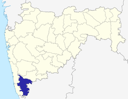 | ||||
| Geography | |||||
| Cities and towns | |||||
| Transport | |||||
| Visitor's attractions | |||||
| Culture | |||||
| Education | |||||
| Lok Sabha Constituencies | |||||
| Vidhan Sabha Constituencies |
| ||||
| Taluka/Tehsil | |||||
| Stadiums | |||||
‡ This constituency also has portions in Sangli district
| |||||
Places adjacent to Mugruwadi | ||||||||||
|---|---|---|---|---|---|---|---|---|---|---|
| ||||||||||